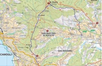
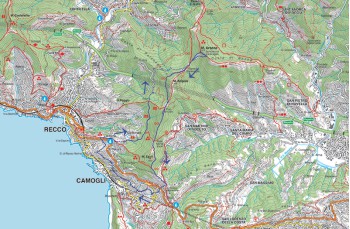
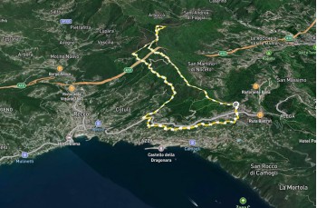
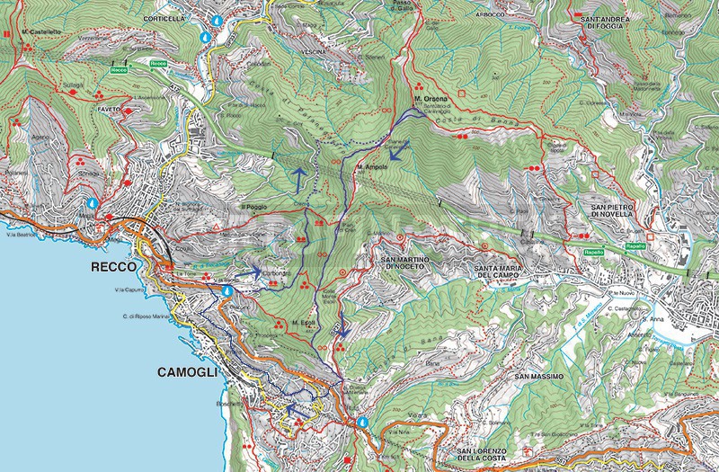
Circular trail from Ruta - San Prospero Monastery - Caravaggio

Difficulty Easy
Duration 4h 20'
Length Km 10,500
Footpath signs Due punti e linea + Due cerchi vuoti
Dislivello 100m - 610m | dislivello positivo 592m | dislivello positivo 592m
StartStarting point
Passing through

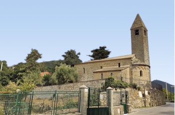
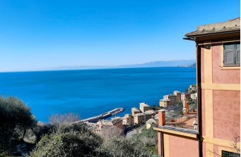
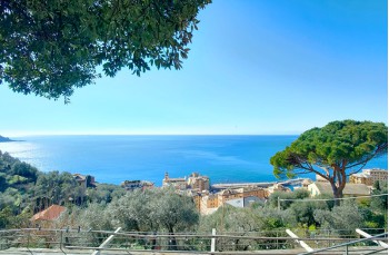
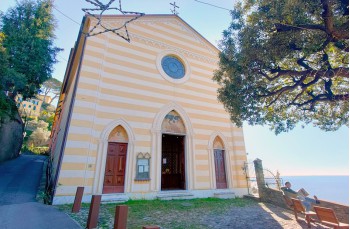
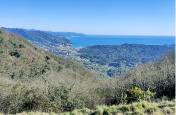
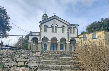
A slightly different itinerary to reach the Santuario di Caravaggio on Monte Orsena, offering varied landscapes and some points of interest.

Since it presents no difficulties, this hike is suitable for everyone. However, it is recommended to bring a sufficient amount of water, as there are no water sources along the way.

The starting point is Ruta di Camogli, accessible by car or bus from Camogli, Santa Margherita Ligure, and Rapallo. Specifically, it begins at Via XXV Aprile, where the Romanesque church known as the “Millenaria” stands in a panoramic position.

Walking along the church’s perimeter wall, you cover a few meters on the provincial road before continuing down a staircase on the right. This is a typical Genoese crêuza, a narrow street flanked by high stone walls and beautiful houses.

After a short descent, turn left until you intersect Via Antica Romana and then Via Aurelia, which connects Ruta to Recco.

With some caution, cross the road to find one of the many pedestrian paths leading down to Camogli. In just a few minutes, you descend onto the drivable Via Enrico Figari, cross it, and continue down Via Sego.

Now continue to the right, enjoying panoramic views over Camogli below and passing by well-maintained houses with gardens, until reaching Via Antica Romana. Here, overlooking Camogli and the entire Golfo Paradiso, stand the church and monastery of San Prospero, a religious building where overnight stays are possible.

Beyond the panoramic terrace, leave Via Romana and take a staircase to the right, which ends in front of a house. From here, continue left on Via Fasceto, a small secondary road that leads to Via San Giacomo.

Descend a few meters, then take the second right onto Via San Giacomo Inferiore.

Continuing along the route, you reach Via Aurelia again, follow it downhill for about ten meters, then cross and ascend a staircase that leads to Via Carbonara, the road that runs through the locality of the same name.

Upon reaching a parking area, follow the trail to the left Two dots and a line which enters the woods. This is a pleasant path, alternating between ascents and level sections, leading to the locality of Cruen (or Piani di Cruen), an intersection of several trails.

Our unmarked itinerary continues straight ahead. Descend to the lower plain, cross a small stream, and pass by an area with a shack and a table with benches before re-entering the forest. At a fork, keep left and descend along the dirt road to the locality Sfiatatoio, named after a highway ventilation shaft camouflaged by vegetation.

Follow the dirt road uphill until reaching an open area in the locality "Fondo sterrata", where a signpost indicates the directions and times to reach the Sanctuary.
From here, the route ascends continuously, and in about 20 minutes, you reach the Piane di Caravaggio. Shortly before arrival, on the left, there is a neviera—a large artificial pit once used to collect and store snow to keep food and beverages cool.

From Piane di Caravaggio, the Sanctuary can be seen atop Monte Orsena. It is reached in about 15 minutes by taking the older and more fascinating, though uneven (avoid when wet), staircase to the left.

At the summit, you are welcomed by a spectacular view over Rapallo and the Golfo del Tigullio, making it a perfect spot for a lunch break.

To return, descend walking the newer staircase in front of the Sanctuary, which leads to the helicopter landing area. From here, continue right to return to the Piane di Caravaggio, this time following the FIE trail marker Two empty circles.

Skirting Monte Ampola path, follow the path through the forest on the Recco side until reaching a trail junction at "Piani di Cren." Here, continue following the same trail marker along the left-hand path.

A forested section leads to Colle Monte Esoli, an exceptional vantage point overlooking Recco and the Golfo Paradiso on one side and Rapallo and the Golfo del Tigullio on the other.

Continuing straight ahead, ignoring the detours, the descent through the forest begins. Shortly, you reach the first houses, where the path becomes a concrete staircase that ends at the Millenaria Church, at the same starting point of this excursion.

The path traced on Google Map

Unlock, view and download the gpx track by becoming a Supporter.

Data sheet

Time
From 4h to 5h
Length Km
10 - 15
Difficulty
Low

Download

Download is reserved for Portofinotrek supporters.

You can support us by becoming one of our Supporters.
A great little help that will allow you to access all the contents of the site.

Learn more.

Are you already Supporter?
Log in now

You might also be interested in