- Out-of-Stock
San Fruttuoso di Camogli - San Rocco di Camogli


ORDER FOR TEMPORARY CLOSURE OF "PASSO DEL BACIO" TRAIL.
With orders from the Mayor of Camogli no. 89 of May 29, 2024, and no. 91 of May 30, 2024, pedestrian traffic is prohibited in both directions on the trail known as "Passo del Bacio" between the locations Batterie and Costa del Termine.
| Difficulty | Medium-High |
| Duration | 4h 00' |
| Length km. | 7,800 |
| Footpath signs | |
This route connects San Fruttuoso in San Rocco di Camogli is, in our opinion, the most evocative of the Park of Portofino but is also particularly challenging because of the presence of some steps on the rock overlooking the sea and the steep initial climb. It 'should bring along a good supply of water along the way because there are no sources. It should be noted also that some sections are very sunny.
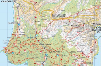
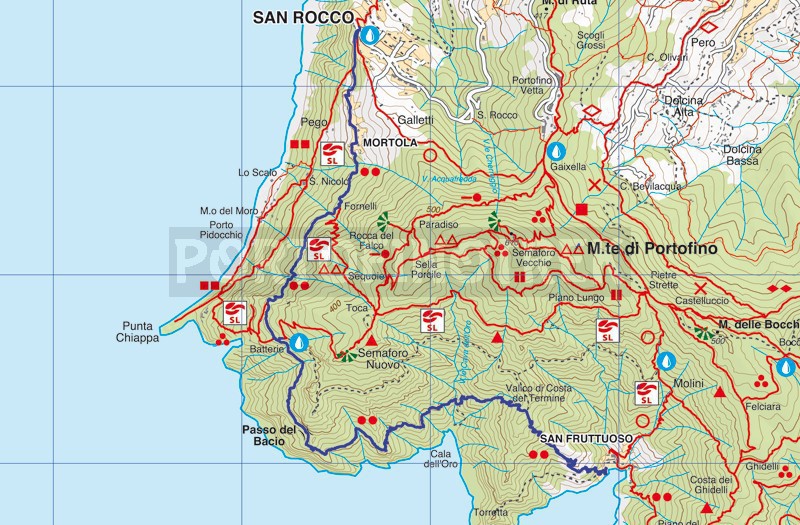
The route begins at the pier, opposite the abbey. Go up along the stone steps to continue with a series of bends in the middle of a forest, where you can see some examples of beautiful pine trees. In about 30 minutes you are at the Valico of the Costa del Termine (257 m above sea level), near Punta Torretta.
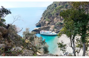
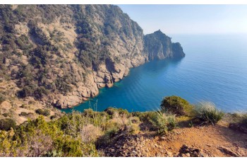
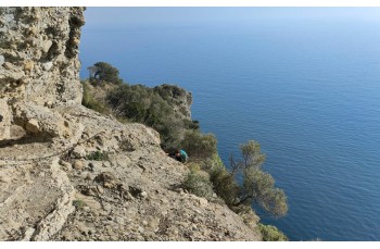
From here a steep (and a little slippery cause of the leaves) down in a shady valley down to get over to Cala dell'Oro, a lovely bay in which access by land and sea is prohibited. After crossing a stream in the dry (summer), begins the most extraordinary of the whole journey, where rocks of the Cape plunge into the deep blue sea below, creating a unique natural spectacle.
The trail, sometimes narrow and irregular, is classified as "very challenging" due to some short sections (one in particular where you cross a rock with few footholds) overlooking the sea; the use of chains assists in the passage, but it is STILL essential to wear suitable shoes and exercise great caution.
It is not recommended for those suffering from vertigo.
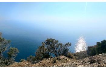
The sight of Punta Chiappa under you pre-announces the arrival in locations Batterie (246 mt. Asl), a viewpoint which owes its name to the remains of the bunker of World War II.
Give up the coast, into the woods with some ups and downs, which are followed by a slight slope up to locations Fornelli (238 mt. Asl), where the path joins from the Toca locations (and Pietre Strette) and moves forward in a smooth between land that they cared more gradually as they approach the first houses.
Cross now the small village of Mortola, and straight on, ignoring the deviation to the left, on the walk to Punta Chiappa "sea view" to the scenic churchyard of St. Rocco di Camogli (here's a tap water , as well as shops and bars).
San Rocco di Camogli is connected to all other destinations by bus service. You can also go down in Camogli by feet (20 minutes).
The path traced by GPS on Google Maps
Unlock, view and download the gpx track by becoming a Supporter.
Data sheet
You might also be interested in
ORDER FOR TEMPORARY CLOSURE OF "PASSO DEL BACIO" TRAIL.
With orders from the Mayor of Camogli no. 89 of May 29, 2024, and no. 91 of May 30, 2024, pedestrian traffic is prohibited in both directions on the trail known as "Passo del Bacio" between the locations Batterie and Costa del Termine.
| Difficulty | Medium-High |
| Duration | 4h 00' |
| Length km. | 7,800 |
| Footpath signs | |