- Out-of-Stock
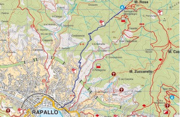
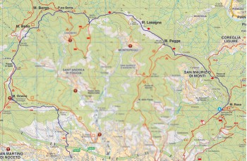
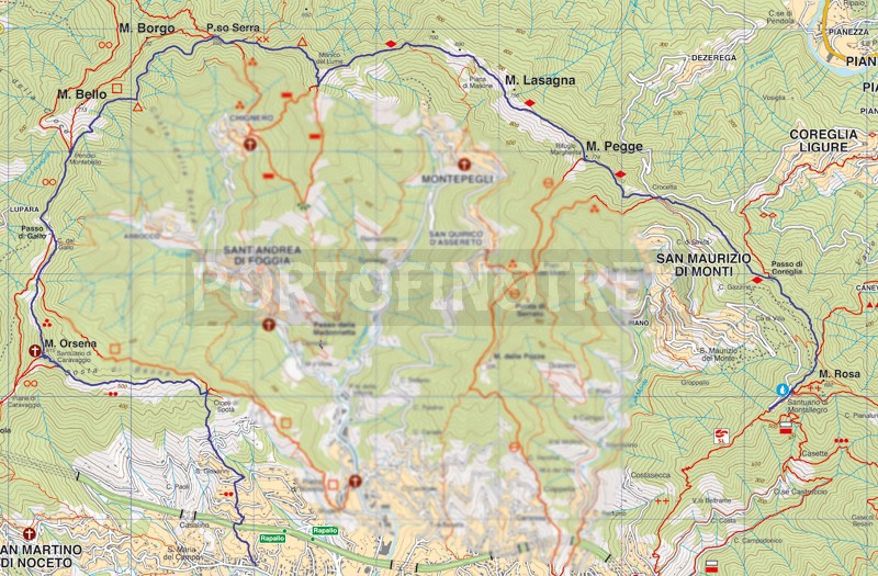
Montallegro - Monte Pegge - Manico del Lume - Caravaggio - Santa Maria del Campo


| Difficulty | High |
| Duration | 6,45' |
| Lenght Km. | 18,300 |
| Footpath signs | |
You can support us by becoming one of our Supporters.
A great little help that will allow you to access all the contents of the site.
Are you already Supporter?
Log in now
CHALLENGING ROUTE CLASSIFIED EE (FOR EXPERIENCED HIKERS) DUE TO SOME ROCK PASSAGES EQUIPPED WITH CHAINS
Since this trail is length, we preferred to reach Montallegro by cable car (a very nice 10 minutes trip from Rapallo), but, wanting that, it'll possibile to walk directly from Rapallo by calculating an extra hour's walk (2.5 kms more). Throughout the journey there are only two sources of water: one behind the sanctuary of...
You can support us by becoming one of our Supporters.
A great little help that will allow you to access all the contents of the site.
Are you already Supporter?
Log in now
You might also be interested in
| Difficulty | High |
| Duration | 6,45' |
| Lenght Km. | 18,300 |
| Footpath signs | |