- Out-of-Stock
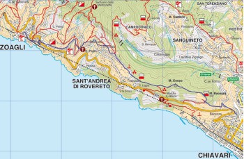
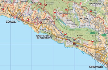
Trail from Chiavari to Zoagli


| Difficulty | Low |
| Duration | 2.30h |
| Length Km | 5,700 |
| Footpath signs | |
This trail starts at the end of the Chiavari seaside promenade, in Corso buenos Aires.
To get there, we recommend taking the seaside promenade (on Corso Valparaiso), which is still worth a visit. La si percorre direzione ponente fino in fondo e percorrendo anche la parte pedonale che porta di fronte alla linea ferroviaria; Follow it in the western direction to the end and also along the pedestrian part that leads in front of the railway line; you pass over the railway arriving at the beginning of the path marked by the follow footpaths ![]() and
and ![]() .
.
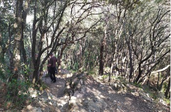
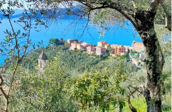
The climb is not very demanding and develops in the shade of an oak wood and offers some panoramic points of Chiavari and the Gulf of Tigullio. On this stretch of the path there is also a sighting building from the Second World War.
After about a kilometer you will arrive next to the Via Aurelia, continue to climb and shortly before arriving at the Church of the Madonna delle Grazie, turn right to go up again into the woods (before turning, we recommend continuing 50 meters further to visit the church and admire the stunning view).
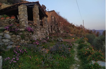
Here the climb becomes a little harder but is only 250 meters long, follow the trail sign ![]() until you reach the end of the staircase at a beautiful panoramic point, in the middle of a group of private stone cottages and where you also meet a new footpath
until you reach the end of the staircase at a beautiful panoramic point, in the middle of a group of private stone cottages and where you also meet a new footpath ![]() .
.
We continue to the left entering the wood again and continue between ups and downs until we cross another trail sign ![]() which takes us to Case Sparse, where we also find a drinking water tap, and then to Costa di Rovereto where at the intersection you take the dirt road on the left, to leave it after about 300 meters turning left and, passing over a Sant 'Andrea di Rovereto, it leads to Via Longarola. Continuing further downhill you will arrive at the church of S. Pietro di Rovereto.
which takes us to Case Sparse, where we also find a drinking water tap, and then to Costa di Rovereto where at the intersection you take the dirt road on the left, to leave it after about 300 meters turning left and, passing over a Sant 'Andrea di Rovereto, it leads to Via Longarola. Continuing further downhill you will arrive at the church of S. Pietro di Rovereto.
Coming down from the churchyard, turn right and then right again, on the path that takes us to Via dei Tessitori which you follow for about 300 meters until you reach the path that soon leads down to Via dei Mulini and then onto the Via Aurelia.
We cross it and descend turning immediately right until we arrive shortly after on the square of Zoagli.
Unlock, view and download the gpx track by becoming a Supporter.
Data sheet
You might also be interested in

| Difficulty | Low |
| Duration | 2.30h |
| Length Km | 5,700 |
| Footpath signs | |