Carasco - Passo di Romaggi - San Colombano - Carasco


| Difficulty | Medium |
| Duration | 5h 20' |
| Length Km | 16,500 |
| Footpath signs | |
This is a circular trail starting from Carasco, a municipality in the hinterland of Chiavari, strategically located at the confluence of Val Fontanabuona, Valle Sturla, and Val Graveglia.
Carasco can be reached by car (look for parking nearby), by public bus from Chiavari, or on foot following the slate cycle path starting in the municipality of Lavagna near the mouth of the Entella River (see starting point).
The starting point is 250 meters after the roundabout, heading towards Fontanabuona, where on the right, there is a somewhat faded sign indicating the 7 Passi trail ![]() , a hiking route created by the Fontanabuona Mountain Community to connect Carasco to Lorsica.
, a hiking route created by the Fontanabuona Mountain Community to connect Carasco to Lorsica.
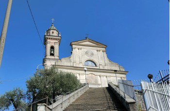
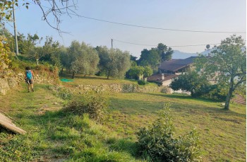
A short stretch on paved road leads to a mule track that starts climbing amidst the countryside, immediately reaching the church of San Pietro di Sturla.
Continuing uphill, you pass a handful of houses in the locality of Case Fontana and continue, crossing the road several times, reaching the hamlet of San Martino.
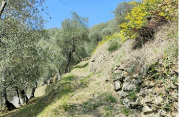
Here, follow the dirt road which later merges onto Via Nino Perazzo where, following the ![]() markers, you find the path that crosses cultivated terraces; a little further, some brambles may make the passage a bit difficult, but the stretch is very short.
markers, you find the path that crosses cultivated terraces; a little further, some brambles may make the passage a bit difficult, but the stretch is very short.
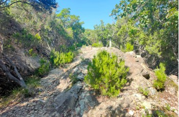
The path then enters a beautiful forest, which in autumn offers plenty of Arbutus trees, and climbs steeply, with some passages on rocky and narrow terrain that require special attention, especially when encountering mountain bikes and motocross bikes.
After passing the location “Costa Banchelle”, you reach a junction where you keep left to reach the summit of Monte Pissacqua (738m above sea level) where you can enjoy a beautiful panorama.
After the ascent, you continue easily on a slight downhill slope in the forest straight ahead, ignoring a first deviation and a second at Passo dell’Anguilla (which will be followed on the return).
The descent heralds the arrival at Passo di Romaggi, the pass between Val Fontanabuona and Val Cichero on provincial road 42, where a sign with a map displaying various trails starting from there has been placed, including the one that, crossing the road, goes up to Monte Ramaceto (see suggested itinerary here below).
To continue our itinerary, you need to retrace the same path as on the way there until Passo dell’Anguilla, where you leave to descend to the right.
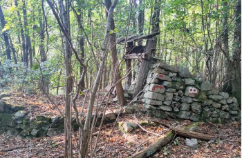
The well-marked trail ![]() descends through a beautiful forest where the remains of an old cable car are visible. After a short stretch on rocky terrain, which could be slippery when wet, you re-enter the forest to descend smoothly until you cross Via Lanà, which you cross to find the mule track that soon ends on Via Antonio Norero.
descends through a beautiful forest where the remains of an old cable car are visible. After a short stretch on rocky terrain, which could be slippery when wet, you re-enter the forest to descend smoothly until you cross Via Lanà, which you cross to find the mule track that soon ends on Via Antonio Norero.
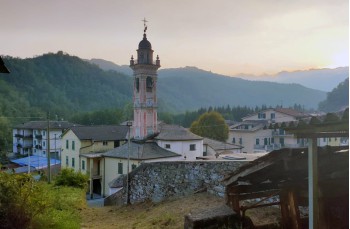
Turn right to follow the asphalt road, sparsely traveled, which leads to the village Vignale; at the junction, keep left following Via Castello di Vignale until the point where, after passing some houses, you spot on the right the path that goes through a forest and shortly after the countryside, when you encounter the first houses of San Colombano Certenoli.
Arriving on State Road 225, follow it for about 500 meters towards left to the first junction, where you turn right onto Via Dante Alighieri to cross the Entella River and go to the other side.
Here, turn left onto Via Scaruglia, which is the slate cycle path (ciclovia dell'ardesia), a secondary road that borders some scattered houses and some warehouses before reaching a bridge that leads to the other side of the river.
Now continue left on the pleasant path that advances on a flat terrain among hazelnut trees and bamboo canes along the river, ending on a road first unpaved, then asphalted, in the locality Loreto, until you reach a pedestrian and drivable bridge, which allows you to cross the Entella River again, reaching the starting point of this itinerary.
Unlock, view and download the gpx track by becoming a Supporter.
Data sheet
You might also be interested in

| Difficulty | Medium |
| Duration | 5h 20' |
| Length Km | 16,500 |
| Footpath signs | |
