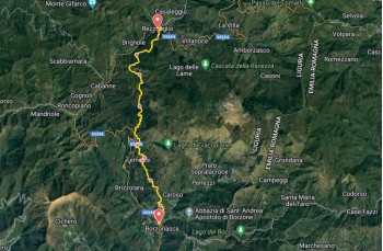
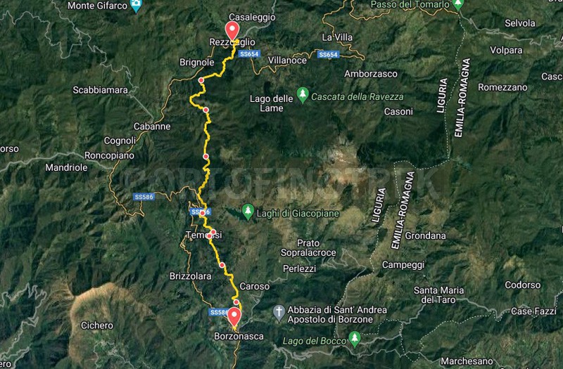
Path of the resistance Borzonasca - Rezzoaglio

| Difficulty | Easy |
| Duration | 7h 00' |
| Length km. | 19,000 |
| Footpath signs | |
"The Path of Resistance" (Sentiero della Resistenza) is a name that recalls the Second World War, when the partisans followed this route, avoiding the more visible main road which in the past was an important communication and trade route between the coast and the Aveto and Sturla Valleys and the Po Valley. In 2023, the trail was completely cleared and restored by CAI and FIE, with the removal of fallen trees and thorns that obstructed some passages, making it walkable again.
The entire route connects Borzonasca, in the Sturla Valley, to Rezzoaglio, the largest municipality in the Val D'Aveto, but shorter stops can be made by taking the bus back to the starting point (check the schedule in advance).
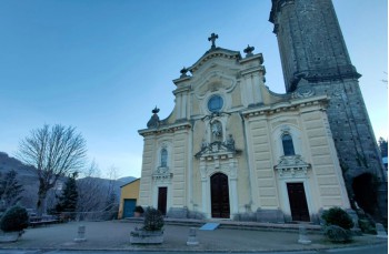
The starting point is in the square of Borzonasca, an inland town in Liguria, reachable in 30 minutes by car from the Lavagna and Chiavari motorway exits by following the direction to Carasco and then SS 586; or by bus on the Chiavari - Santo Stefano D'Aveto line.
From Piazza Severino, in the heart of the village, continue on Via Carlo Marrè, the small street that crosses the inner part, until you reach the headquarters of the Aveto Park, where, on the left, you take the staircase that goes up between the houses; the trail marker ![]() instructs you to continue uphill.
instructs you to continue uphill.
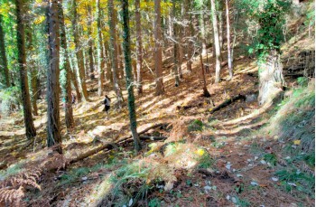
After a few meters, the stairs intersect with Via Giacomo Croce before entering, for a short stretch, the woods, and finding the drivable road that, this time, you must follow to the left to resume the steep path to Caregli village (441 meters).
Here, there is a drinking water tap.
It is recommended to take a short detour to the left to see the church of Santi Vincenzo e Anastasio, which with a plaque testifies to the massacre of citizens carried out by the fascists.
Back on the trail, you pass through the partially renovated houses of this village, offering the opportunity to see some examples of ancient farmhouses.
The trail marker ![]() now invites you to continue to the left to reach a plain with some houses in the locality of Gua Moà.
now invites you to continue to the left to reach a plain with some houses in the locality of Gua Moà.
Continuing to the right, accompanied by a beautiful view of the surrounding peaks, you begin to climb again, reaching a beautiful plateau ideal for a short break.
Here, pay attention to the trail marker to resume the trail, not exactly visible, which leads to crossing the woods and, after the small cluster of houses in Barca di Gazzolo, where you can find another drinking water tap.
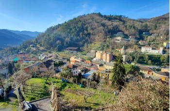
A long flat stretch, along a farm with friendly courtyard animals, precedes the descent into the woods, which in the final part gives way to vast green meadows surrounding the village of Poggio a Temossi, a few meters away from Temossi village just below.
In the locality, there are some places rent rooms, and for those who want to interrupt the journey, there is the possibility to descend to SP 586 (about 2 km), where the bus passes (check the schedule).
After the last house in Poggio a Temossi, keep to the left to climb to Montemozzo, another inhabited area where you have to follow the road for a while before entering the woods and following the trail that goes up to a crossroads.
You cross the path that goes up to the Giacopiane Lakes; go downhill towards Villa Jensi, a group of houses built on the provincial road not far from Bertigaro, which you bypass to stay on the trail with the trail marker ![]() that soon arrives at a junction; the trail marker leads to the right path that goes up and then descends into the woods, but with the left one, you avoid the ascent by passing through the locality of Prorè and reconnecting shortly after with the other trail.
that soon arrives at a junction; the trail marker leads to the right path that goes up and then descends into the woods, but with the left one, you avoid the ascent by passing through the locality of Prorè and reconnecting shortly after with the other trail.
From Prorè, it is possible, in a few minutes, to reach the provincial road.
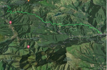
After a stretch of dirt road, the climb resumes, alternating between passages in the woods and more open stretches surrounded by the surrounding peaks, crossing green expanses.
The path intersects the Sturla stream at several points, which must be forded, and, especially at one point, after heavy rains, it could be difficult.
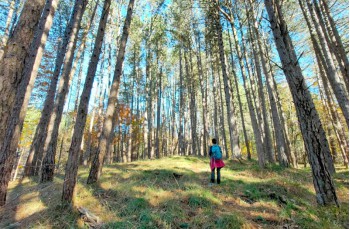
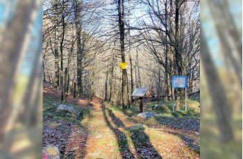
As you lose altitude, and the climb becomes more challenging, you find yourself immersed in a beautiful forest of firs and maritime pines until you reach Passo Bisinella, also known as Passo delle Rocche (1125 m above sea level).
It is a strategic point on the High Route of the Ligurian Mountains (Alta Via dei Monti Liguri), as it allows you to reach different destinations, as can be learned from the Aveto Park panel.
Here, as a sign of gratitude to the partisans and the villagers who fought in these places, CAI and FIE have placed a plaque, and there is also a descriptive panel about the trail you are walking on.
From this point on, the trail marker becomes yellow ![]() (the color differentiates the trails of the sea side from the mountain side) and indicates to continue straight, descending towards Villa Cella.
(the color differentiates the trails of the sea side from the mountain side) and indicates to continue straight, descending towards Villa Cella.
After a short initial descent covered with leaves, slippery in particular weather conditions, the path becomes very pleasant, continuing flat along the stream before descending back into the beech forest.
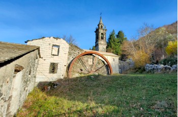
Arriving at Fossato Grande, a wooden bridge facilitates the crossing and leads to the short ascent to the village of Villa Cella.
The village is located on an ancient trade route, "la mulattiera della Pria Martina", used between the 11th and 16th centuries for the exchange of goods between the coast and Val D'Aveto (source: Carlo Gatti - marenostrumrapallo.it).
As evidence of this period, next to the church, you can still see the remains of the monastery built by the Benedictine monks to offer shelter and support to the numerous travelers.
Among the houses, partly uninhabited today, one is still active as a farmhouse, where you can have lunch and dinner (by prior arrangement).
Villa Cella is about 3 km from the provincial road.
To resume the trail, follow the mule track below the church, which, after leaving the last house, enters the woods to reach, after about 20 minutes, a clearing where a small stone chapel has been built, the Chapel of the Madonna dell'Alpe.
Continuing to descend gently into the woods, you encounter a first stream that is easily crossed before reaching a crossroads, where it is recommended to take a left turn for a short visit to Costafigara, another village where the atmosphere of the past still lingers, thanks to its ancient stone houses and the prevailing peace.
Back on the main trail, leave the main trail to follow the trail marker ![]() and climb steeply before continuing flat to the left.
and climb steeply before continuing flat to the left.
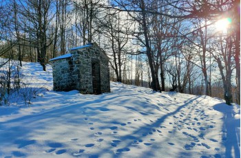
In this stretch, you cross small streams and pass a couple of farms that can offer a spartan shelter in case of bad weather.
Shortly, the descent into the woods towards Rezzoaglio begins, which is reached after about an hour when the trail ends behind a beautiful villa.
To descend onto the asphalt road, take a path that is identified to the right; from here, turning left, you reach the center of the village where there are various services, bars, restaurants, and some companies producing typical products of Val D'Aveto, excluding accommodation facilities (at the moment).
To return to Borzonasca, check the bus schedules serving the Santo Stefano D'Aveto - Chiavari line.
Unlock, view and download the gpx track by becoming a Supporter.
Data sheet
| Difficulty | Easy |
| Duration | 7h 00' |
| Length km. | 19,000 |
| Footpath signs | |