Circular trail Borzonasca and Lago di Giacopiane


| Difficulty | Low |
| Duration | 6h 00' |
| Length km. | 16,400 |
| Footpath signs | |
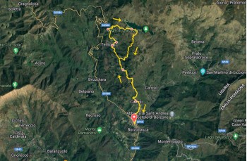
This is an itinerary in the Sturla Valley to reach the Giacopiane Lakes, starting from Borzonasca, a town in the Ligurian hinterland just 30 minutes by car from the coast.
From the motorway exits of Lavagna and Chiavari, follow the direction to Carasco and then SS 586; the village is also on the Chiavari - Santo Stefano D'Aveto line served by local buses.
Due to the significant elevation gain, the route is recommended for experienced hikers.
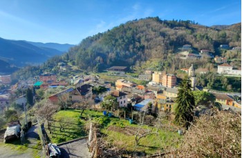
The starting point is in the center of Borzonasca, on Via Carlo Marrè, which is followed to the headquarters of the Aveto Park. On the left a staircase climbs and immediately reaches a crossroads. Here, take the leftmost path with a trail marker ![]() .
.
This is the "Resistance Trail," a historically significant path that connects Borzonasca to Rezzoaglio, used by partisans to avoid the main road avoiding to be captured by German militias too.
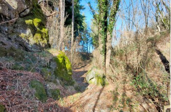
The staircase, after crossing Via Giacomo Croce, enters the woods for a short stretch before emerging again on the drivable road, which must be followed to the left to then find the trail climbs steeply to the village of Caregli (441 meters).
Here, there is a drinking water tap.
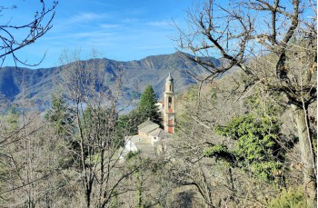
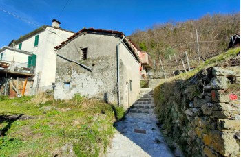
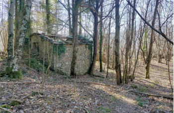
It is recommended to take a short detour to the left to see the 15th-century church before crossing the farming village, where next to renovated houses, some buildings (or parts of them) still resist in their original structure.
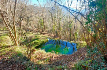
Now, ascend to the right into the woods where there is also a small waterfall, always with trail markers ![]() , to reach a plain with some houses in the locality of Gua Moà.
, to reach a plain with some houses in the locality of Gua Moà.
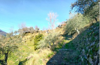
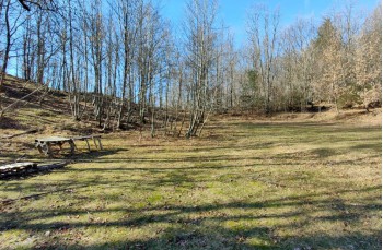
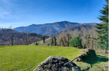
The path now continues to the right, offering some panoramic views of the surrounding peaks, and, starting to climb again, reaches a beautiful plain field, ideal for a regenerative stop.
Here, pay attention to the footpath sign to resume the trail, which in short, leads to another small village, Barca di Gazzolo, where a sign indicates that here there was a "Trattoria". Now there is no trattoria, but there is a drinking water tap.
With a flat stretch, pass by a farm, then re-enter the woods and descend to cross a greener environment with large meadows, anticipating the entrance to the village Poggio di Temossi.
Cross it to continue uphill to the left, to another cluster of houses in the locality of Montemozzo, where you continue for a stretch on the road before re-entering the woods and following the trail that climbs to the intersection where you leave the Resistance Trail to continue uphill to the right following ![]() .
.
Now face the final uphill stretch following the path crossing meadows, alternating passages in the woods to reach, after about 40 minutes, the Giacopiane Lakes (1015 meters); in the final part, the trail is not always clear, so pay attention.
After the inevitable stop enjoying the landscape and have a lunch break, resume the journey by following the lake toward south for a few meters until you identify, on the right, a sign from the Aveto Park with directions to descend.
The trail to follow is now an ![]() that must always be kept in view as it guides in the descent that does not follow a clear path.
that must always be kept in view as it guides in the descent that does not follow a clear path.
Every so often, you also come across some signs from the Aveto Park with directions (some without directions, others fallen to the ground).
After a few meters, you reach a crossroads; here, continue to the left to continue the descent into the woods.
Arriving in a pine forest with a curious boundary wall, follow it on the right for about 50 meters before exiting and continuing to descend into the woods and reaching a deforested stretch. A road traced by tracked vehicles leads to the path traveled on the way there.
Here, continuing to the left, retrace the same path traveled on the way there, shortly after encountering the farm. By crossing the small hillside villages again, you return to Borzonasca where there are shops of all kinds and a renowned pastry-ice cream
Unlock, view and download the gpx track by becoming a Supporter.
Data sheet

| Difficulty | Low |
| Duration | 6h 00' |
| Length km. | 16,400 |
| Footpath signs | |