- Out-of-Stock
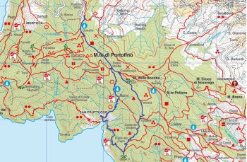
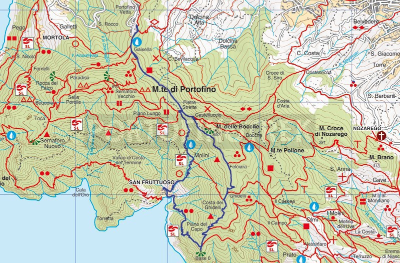
Portofino Vetta - Base 0 - San Fruttuoso - Pietre strette


| Difficulty | Medium - High |
| Duration | 3h 00' |
| Length km. | 7,300 |
| Footpath signs | |
You can support us by becoming one of our Supporters.
A great little help that will allow you to access all the contents of the site.
Are you already Supporter?
Log in now
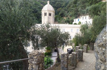
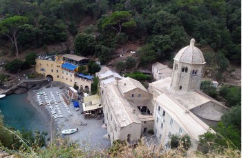
The path, mostly flat with some gently sloping sections, starts from the entrance of the Park (420 meters above sea level), behind the Hotel and passing under the somewhat unsightly Rai antennas. After 5 minutes, it reaches the location of Gaixella.
This small area, a crossroads of numerous trails (Semaforo Nuovo, Semaforo Vecchio, San Rocco), is equipped with benches, wooden tables, and a drinking water tap.
...You can support us by becoming one of our Supporters.
A great little help that will allow you to access all the contents of the site.
Are you already Supporter?
Log in now
| Difficulty | Medium - High |
| Duration | 3h 00' |
| Length km. | 7,300 |
| Footpath signs | |