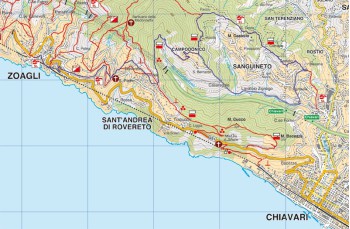
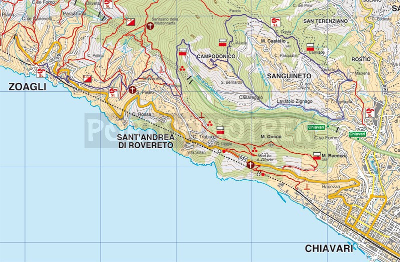
Zoagli - Campodonico - Sanguineto - Chiavari - Zoagli

Difficulty | Medium - high |
Duration | 4h 45' |
Length Km | 14,300 |
Footpath signs | ![]() ![]() ![]() ![]() ![]() |
![]() ![]() ![]() | |
![]() |
We have classified this itinerary of medium-high difficulty in particular for the duration and the climb that must be faced from San Pier di Canne to Campodonico. We also point out that along the entire route there are no sources or drinking water faucets.
The departure is from Zoagli square taking the stairway to the left (looking at the sea) that goes up, follow the signs to San Pietro di Rovereto .
Once on Via Aurelia, go uphill for a few meters then cross it and continue following the signs, on the left, towards San Pietro:
it is an asphalted road which passes in front of a one of the last two silk factories left in the town, then continuing uphill between the houses. After about 10 minutes, take the staircase on the left Salita Montà , which leads you directly under the church of San Pietro.
Once we arrive at the church square, we take the staircase on the left that goes up and merges into Via Longarola, which we follow until in front of one of the first houses we meet we find a path that starts on the right direction Sant'Andrea of Rovereto.
It is a pleasant flat path, initially cemented which then becomes a grassy path, with a spectacular view of the Promontory of Portofino and the Gulf of Tigullio and passes over the church of Sant 'Andrea di Rovereto and then flows onto a gravel road that runs along about 400 meters until it crosses the path coming from Chiavari.
We turn left and climb a few meters to immediately take the detour to the right marked with the symbols and
.
Here begins a very pleasant path almost entirely flat or with some ups and downs that crosses woods and cultivated land flanked by old cottages often abandoned and unsafe which leads us to the hamlet of Campodonico .
We continue for a short distance on the asphalted road until we arrive under the church where a flight of steps takes us to the path above the road; walking along it for a few hundred meters we arrive at the small and pretty Church of S. Bernardo in Campodonico.
We take the path which starts behind the church going into the woods going up quite steeply for about 300 meters arriving at a crossroads, in Via della Crosa-Via della Costa, which offers the possibility to continue in various directions, we choose to go right and begins to descend slightly towards Sanguineto.
It is a beautiful path in the midst of chestnut trees and which occasionally opens into fields of olive trees with panoramic views over the city of Chiavari. In a very imperceptible way you go down until you cross the Montallegro - Chiavari path in "Vic. Della Costa Campodonico". Here we immediately turn right and continue the descent through cultivated fields towards the town of Sanguineto following the sign of the empty red triangle .
You arrive on an asphalted road which you follow up to the Church of S. Antonio in Sanguineto where you immediately take the path to the right which continues to descend and which, after about 700 meters, takes you to Via Gandolfi. Continue on the asphalted road towards Maixena and, about a hundred meters before the church, take the stairway to the right (well signposted) which continues to descend crossing and sometimes alongside the carriage road that leads from Chiavari to Maixena.
We then arrive at San Pier di Canne where we decide to follow the marker post that shows us the way back to Campodonico; here the signs to follow are always
.
You will walk along a nice stretch of flat path, for about 1.2km along the Campodonico stream, after which you will start to climb steeply. The climb is not too long (about 600 meters), it is steep and tiring, it takes us first to the side of the cemetery and after a few meters back to the church of San Bernardo which we met on the way. We stop right by the church to catch our breath...
From here it will be sufficient to follow the path of the outward journey as it is to return first to Rovereto then to San Pietro di Rovereto and finally in Zoagli.
Unlock, view and download the trail track by purchasing a map.
Data sheet
You might also be interested in