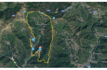
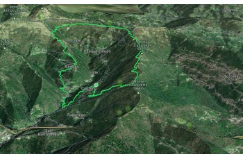
Ring trail Capreno - Case Cornua - Canepa - Lago

Difficolty Medium
Duration 4h 20'
Length Km 12,000
Footpath signs x.png + 2linee-veriticali.png + 3-pallini-in-linea.png
Dislivello 60m - 621m | dislivello positivo 673m | dislivello positivo 672m
PartenzaStarting point
Passing through

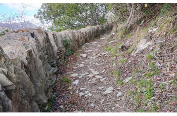
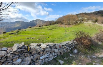
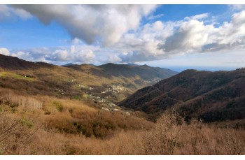
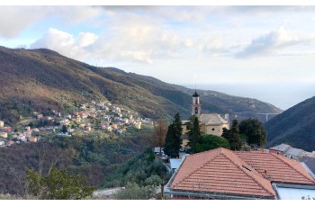
This is a circular itinerary starting from Capreno, a hilly hamlet close to Sori located about 2.5 kilometers away, which can be reached by private vehicles by going up from the center of the town or by using the infrequent bus service.
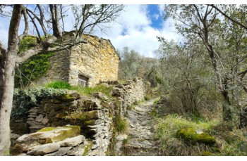
In front of the church, there is a tap providing drinking water.

The route starts with the little road that passes to the left of the Church of San Pietro Apostolo, and winding among the houses, it reaches the beginning of the trail that climbs in a highly pleasant setting, in a territory formerly cultivated, as evidenced by the presence of terraces and numerous stone farmhouses.

After passing a last stone farmhouse, better preserved than the previous ones, from which a beautiful panorama can be enjoyed, the final uphill stretch is covered, which ends at the Piane di Capreno, which, as the name suggests, is characterized by wide green plains.
Here you take the path on the left that goes around Mount Cassinea (FIE foothpath sign due linee verticali), It mainly advances on level ground with some very open and panoramic sections overlooking Sori, where you can admire the typical border walls made with a succession of large vertical stones.

After encountering a sign indicating "Case Cornua 0h,20', (Here, the x.png trail marker is added.), With an uphill stretch, you reach the provincial road that leads towards Monte Fasce, which you follow for a few meters to reach the Cappelletta degli Alpini, a stone chapel that stands on a scenic hill overlooking the Gulf of Paradiso. From here, you continue on the trail that leads back to the drivable road at Case Cornua place, where there are some houses and one tipycal restaurant and bar.

Just in front of the restaurant, you descend slightly to the left along the drivable road for few meters, finding on the right the trail (not so evident) that allows you to descend towards the hamlet of Canepa. It is a rocky path that descends into the woods, less interesting than the previous sections but without particular difficulties, until reaching the slopes of Monte Becco where a fork in the path is encountered.

After taking a look to the right at the beautiful village of Levà, with its colorful houses, our itinerary continues straight ahead, following this footpath sign tre pallini, towards Canepa, a charming hamlet of Sori that you pass through, first passing by the church of Santa Maria Assunta and then entering the heart of the village, on the left, by walking along a small alley that ends on the drivable road again.
There is also a drinking water faucet here.

Following the same trail marker, you take the path that intersects the road a couple more times before descending, with an initially not particularly well-maintained stretch, to the lower hamlet called Lago.
Once you arrive at the drivable road, you must pay attention because the path that goes back up to Capreno is not easily identifiable: after passing the church, you exit the village, cross a bridge, and after about 200 meters on Via Caorsi, on the left, a faded signpost indicates the direction to follow.
It is a mule track that climbs, quite steeply, among the terraced fields to reach the provincial road in just under twenty minutes. From there, you take Salita al Castello, a flat alley that runs alongside the drivable road and quickly leads back to the starting point of the hike.
For those arriving in Capreno at lunchtime or dinner, we note the presence of two trattorias that offer local cuisine.


Unlock, view and download the trail track by purchasing a map.

The path tracked tracciato by GPS

Data sheet

Time
From 4h to 5h
Length Km
10 - 15
Difficulty
Medium