- Out-of-Stock
San Fruttuoso di Camogli - Base 0 - Portofino


| Difficulty | Medium |
| Duration | 2h 50' |
| Length km | 4,200 |
| Footpath signs | |
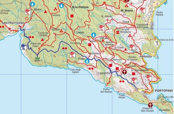
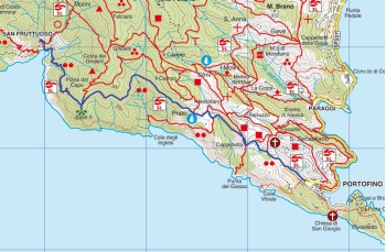
This itinerary is for those who, arriving at San Fruttuoso from San Rocco di Camogli or Portofino Vetta, wish to return following a different path.
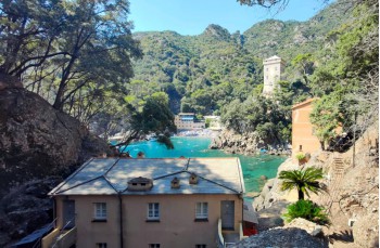
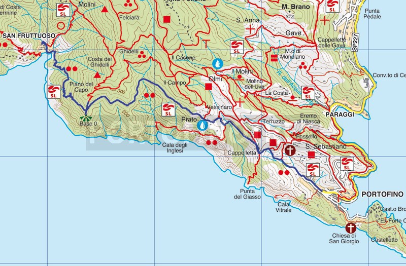
From the small square in front of the church of San Fruttuoso, take the path that, passing under Torre Doria, leads to the pebble beach and continues among the fishermen's houses. Once you reach the helicopter landing base, a steep and uneven climb awaits you, winding its way through the forest and offering beautiful panoramic views.
After about 40 minutes, you'll come to a fork, Base 0, a military post from Second World War. To the left, the path ascends towards Portofino Vetta, but you should keep to the right, following the western side of the promontory.
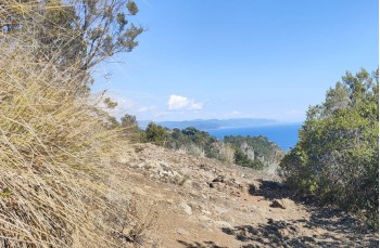
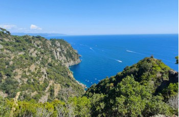
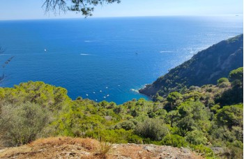
The route is now undemanding but incredibly beautiful. The path alternates between flat sections and numerous ups and downs among protruding rocky outcrops, all the while overlooking the sea and revealing the underlying coves.
Only occasionally will you turn away from the seascape to cross a shaded valley, providing relief on particularly sunny days.
Arriving at the Prato area, where there is also a drinking water tap, continue straight ahead, descending a steep but short drivable road that leads to a chestnut forest. Shortly after, at Vessinaro, ignore the right turn that leads down to Cala degli Inglesi, and instead, continue along the narrow and flat path that now advances through the countryside.
At the fork (turning left the path leads to Portofino Vetta), continue straight until you reach the Cappelletta area where, under a small chapel, you'll find a gate to cross.< /p>
Descend along the trail, ignoring any deviations. The final stretch of the path consists of a wide and well-maintained stone and concrete staircase surrounded by shrubs, ending on Via del Fondaco.
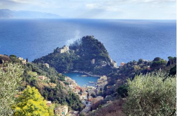
Continuing straight, you'll reach the famous "piazzetta" of Portofino.
The trail traced byGPS on Google Maps
Unlock, view and download the gpx track by becoming a Supporter.
Data sheet
You might also be interested in
| Difficulty | Medium |
| Duration | 2h 50' |
| Length km | 4,200 |
| Footpath signs | |