- Out-of-Stock
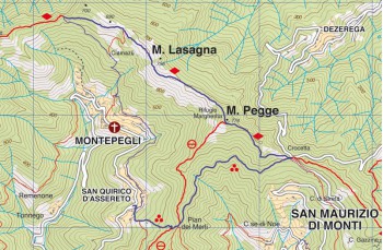
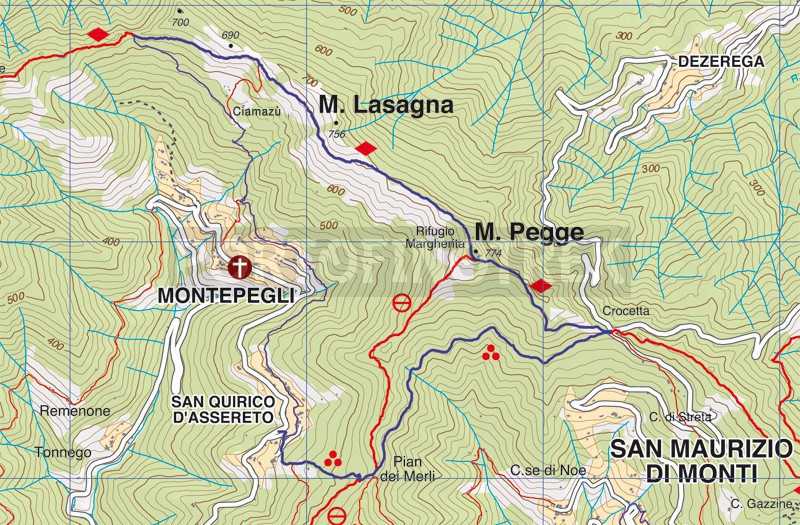
San Quirico di Assereto - Montepegli - Monte Pegge - Pian dei Merli


| Difficulty | Media |
| Duration | 3h 00' |
| Length Km | 7,400 |
| Footpath signs | |
You can support us by becoming one of our Supporters.
A great little help that will allow you to access all the contents of the site.
Are you already Supporter?
Log in now
What we propose here can be considered the longest version of the Cian Mazùn ring, which we proposed here .
The departure is from San Quirico di Assereto , a small hamlet of Rapallo which can be reached in about 15 minutes by climbing from Via Puchoz and continuing on ...
You can support us by becoming one of our Supporters. Are you already Supporter?
Content reserved for Portofinotrek supporters.
A great little help that will allow you to access all the contents of the site.
Log in now
| Difficulty | Media |
| Duration | 3h 00' |
| Length Km | 7,400 |
| Footpath signs | |