- Out-of-Stock
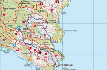
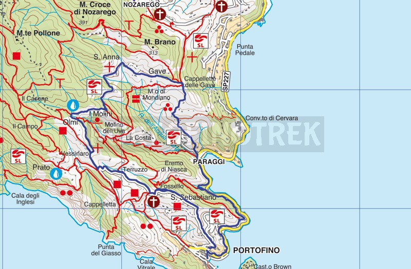
Portofino - Olmi - Gave - Paraggi - Portofino


| Difficulty | Low |
| Duration | 2h 30' |
| Length km. | 6,200 |
| Footpath signs | |
In front of the bus stop, near the parish church of Portofino, begins the pedestrian path, to the left, which leads to Portofino Vetta; an uphill route, at times particularly steep, that winds between high walls from which you can catch glimpses of beautiful villas and meticulously maintained gardens.
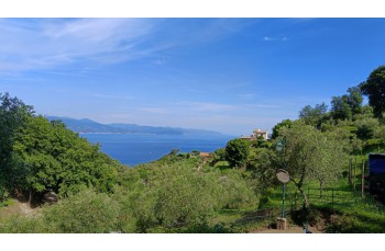
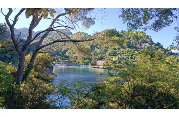
This first part of the route is accompanied by enchanting views of the Gulf of Tigullio and the bay of Paraggi.
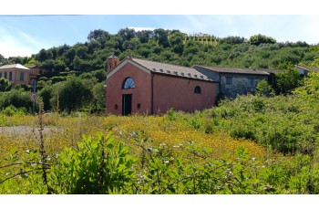
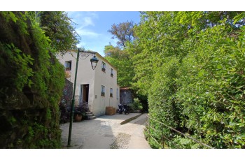
The driveable path*, wide and well-maintained, passes through the hamlet of San Sebastiano, a small cluster of houses around a little red church, and as it climbs between terraced hillsides, it reaches a rest area equipped with facilities, where it intersects with the trail coming from San Fruttuoso.
From here, always following the symbol (![]() ), the path continues uphill through olive groves to the location Olmi (250 m a.s.l.), where, to the right, you’ll find the junction to Nozarego.
), the path continues uphill through olive groves to the location Olmi (250 m a.s.l.), where, to the right, you’ll find the junction to Nozarego.
The mostly flat trail passes the Mulino del Gassetta (252 m a.s.l.), an old mill converted into a refreshment point, and continues through the countryside; after a downhill stretch in a shady valley, the trail passes by some houses and cultivated terraces to reach a small chapel, at the location Cappelletta delle Gave (168 m a.s.l.).
In both places, there is a drinking water tap.
From here, to the right, a steep mule track starts, skirting terraces, dry-stone walls, and scattered houses, descending in about 20 minutes to the Paraggi parking area, next to a hotel.
After walking a few meters along the paved road, on the right you’ll find the access path to the “lovers' walk”: a green trail, parallel to the road below, connecting Paraggi to Portofino.
After a series of ups and downs, the path continues flat before descending toward the renowned Ligurian village.
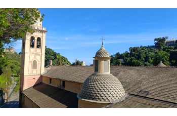
The arrival in Portofino is heralded by incredible views of the bay filled with luxurious yachts, of Brown Castle, and of the famous little square; the trail ends in front of the church of San Martino.
*Road reserved for local residents, accessible by scooters or small vehicles.
The path traced by GPS on Google Map
Unlock, view and download the gpx track by becoming a Supporter.
Data sheet
You might also be interested in
| Difficulty | Low |
| Duration | 2h 30' |
| Length km. | 6,200 |
| Footpath signs | |
