Ring trail of Monte Telegrafo in Chiavari


| Difficulty | Low |
| Duration | 3.00h |
| Length Km | 9,400 |
| Footpath signs | |
The loop itinerary of Monte Telegrafo is a classic route that is not particularly scenic but very enjoyable, as it mostly winds through the woods, making it a suitable path even on summer days.
It is called this way because on Mount Cucco you can still see the ruins of the Napoleonic optical telegraph, which was in operation here from 1807 to 1815, when it was dismantled by the Savoy.
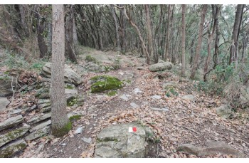
The starting point is on Via Fiume, at the exit of the Chiavari highway toll booth, with Via Descalzi, the staircase that immediately meets on the right (with your back to the roundabout) and leads shortly to Via Aurelia, which you follow uphill for a few meters before turning right to find the trail again (![]() ) which initially ascends gently, and after crossing paths with the main trail marker, it becomes steeper. Shortly after, you will come across a stone staircase that crosses some terraced fields with a few rustic buildings before entering the woods and reaching Mount Cucco, also known as Monte Telegrafo..
) which initially ascends gently, and after crossing paths with the main trail marker, it becomes steeper. Shortly after, you will come across a stone staircase that crosses some terraced fields with a few rustic buildings before entering the woods and reaching Mount Cucco, also known as Monte Telegrafo..
Always follow the same footpah sign ![]() , even when you encounter different signs, you will travel a long stretch through the woods, first downhill and then with a final uphill section. You will eventually reach a road that runs alongside some houses in the locality of "Case Sparse di Sant'Andrea di Rovereto", where there is also a tap with drinking water.
, even when you encounter different signs, you will travel a long stretch through the woods, first downhill and then with a final uphill section. You will eventually reach a road that runs alongside some houses in the locality of "Case Sparse di Sant'Andrea di Rovereto", where there is also a tap with drinking water.
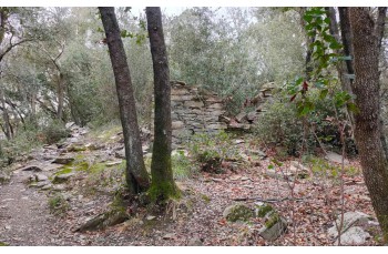
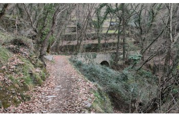
Continuing to the end of the road, you will reach a junction where you must keep to the right, passing in front of a beautiful stone house, to head towards Campodonico. You will reach it via a trail that winds mostly through the woods, characterized by some abandoned rustic buildings and a nice stone bridge.
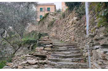
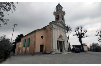
Upon entering the village of Campodonico, you will take the staircase that you will encounter on the left after a few meters, before reaching the church, where a sign indicates the various directions. You will climb the stairs and cross the oldest part of the hamlet, among cultivated terraces and rural houses, enjoying a beautiful panoramic view of the Golfo del Tigullio.
The trail then re-enters the woods and reaches a junction where, always following the same trail marker, you will find yourself on the path that descends from Montallegro. You will turn left and continue downhill, passing by "Baita Facciu", a small wooden hut owned by a private individual, which hikers can access and use (with due respect).
Continuing downhill, you will come across a group of houses called "Case Costa", where you will also find a tap with drinking water. After walking along a more open stretch that allows you to admire the view, you will reach a junction where a stone staircase leads to the square in front of the church of "Maixena".
From here, another staircase descends among the houses and ends up in "Sampierdicanne" on a paved road that you will follow to the left to reach the parish of San Pietro, where our itinerary ends.
Continuing straight ahead, in about 25 minutes you will reach the Chiavari train station. If you want to go back to the starting point of the route, it is recommended to turn right onto Via Colonnello Enrico Franceschi.
Unlock, view and download the gpx track by becoming a Supporter.
Data sheet

| Difficulty | Low |
| Duration | 3.00h |
| Length Km | 9,400 |
| Footpath signs | |