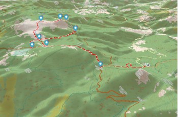
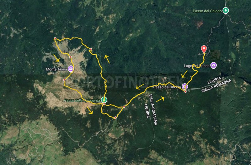
Circular trail Casermette - Monte Aiona - Prato Mollo


| Difficulty | Medium - High |
| Duration | 5h 00' |
| Length Km | 14,500 |
| Footpath signs | |
The trails leading up to Mount Aiona, a peak of the Ligurian Apennines at 1700 m, are varied and differ in difficulty levels.
Here we propose an itinerary that develops in Liguria with a short passage in Emilia Romagna, recommended for more experienced hikers due to its length and the stretch along the northern ridge of Mount Aiona.
A hike that can be done all year round, but not recommended in wet conditions due to the rocky ridge section
The starting point is the Casermette del Monte Penna refuge at 1390 m (possibility to eat and sleep here for most of the year, but it is advisable to check opening periods and availability in advance). It can be reached by taking the SP 586, which connects Chiavari to Val D’Aveto, up to the locality of Gramizza, where you turn right, passing the hamlets of Amborzasco and Casoni di Amborzasco (about 15 minutes by car from the junction).
It is recommended to start with a good water supply because the only spring encountered is near the Monte Aiona refuge in Pratomollo.
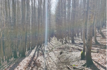
After easily parking the car, follow the wide dirt road to the right, which crosses a beautiful beech forest and gently climbs for just under half an hour to the Passo dell’Incisa (1471 m), where several trails converge.
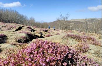
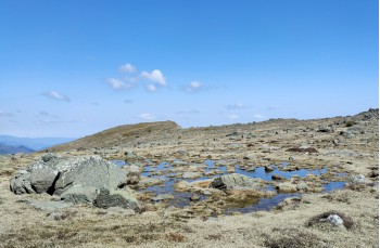
Our route now follows to the right the trail markers of the Alta Via dei Monti Liguri ![]() climbing through the beech forest, with some steep sections, up to the slopes of Mount Cantomoro, then emerging from the woods and crossing a clearing to reach the Prati di Montenero, a wide marshy grassland dotted with stones, particularly striking in spring when the heather is in bloom.
climbing through the beech forest, with some steep sections, up to the slopes of Mount Cantomoro, then emerging from the woods and crossing a clearing to reach the Prati di Montenero, a wide marshy grassland dotted with stones, particularly striking in spring when the heather is in bloom.
Upon reaching a junction with a signpost of the Aveto Park, continue to the right toward Passo della Spingarda, which is reached in just over 15 minutes.
Ignore the trail that climbs to Aiona — which you will take later on the descent — and continue along the wide dirt road marked with ![]() heading toward Gramizza.
heading toward Gramizza.
After a flat stretch, the forest road enters the woods and descends in a series of switchbacks, passing by the Ronco del Diavolo waterfall before reaching a panoramic viewpoint overlooking the valley.
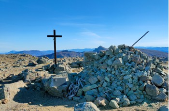
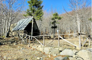
After a few meters you arrive at Re di Coppe, a crossroads of four trails, and nearby stands the Moglia Negretta Refuge, a welcoming unmanned shelter very useful in case of adverse weather. Outside there is also a table with benches.
Our route continues on the trail to the left, marked with ![]() climbing through a beech forest to the Passo del Cerighetto (1450 m).
climbing through a beech forest to the Passo del Cerighetto (1450 m).
Following the direction toward Lago di Sopra for a few meters, pay close attention to identifying, on the left, the point (not very obvious) where the trail branches off toward the summit of Aiona.
This stretch is recommended for experienced hikers and should be avoided in wet conditions or unfavorable weather.
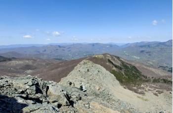
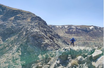
A steep but short ascent through the woods leads to the rocky ridge, an exciting section requiring attention and, in some cases, the use of hands, especially on a narrow short descent that leads to the base of the summit.
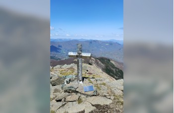
A few more rocks to climb over, then continue across a grassy area leading to the North summit of Mount Aiona. Guided by trail markings on some rocks, though without a precise track, continue to the main summit of Mount Aiona at 1701 m, recognizable by its cross and compass rose. In favorable weather conditions (though it is often windy and foggy), it’s impossible not to stop and enjoy the breathtaking view.
Following the clear markings on the rocks, descend back to the Passo della Spingarda, this time heading left along the trail marked with ![]() ,
, ![]() ,
, ![]() gently losing altitude while crossing flat areas with the characteristic rocks also found on the summit.
gently losing altitude while crossing flat areas with the characteristic rocks also found on the summit.
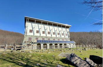
In about 20 minutes you reach Passo della Spingarda again. Follow the dirt road downhill to reach the Monte Aiona refuge in Pratomollo within a few minutes (generally open from April to October). Even if the refuge is closed, it’s an excellent place for a break.
Here you will find a potable water spring.
Right behind the refuge is the trail that climbs up to the Prati di Montenero, marked with ![]() . From here you will find yourself at the same signpost encountered earlier; simply follow the same trail back to the Passo dell’Incisa and then to the Casermette del Penna, where this itinerary in the Aveto Valley comes to an end.
. From here you will find yourself at the same signpost encountered earlier; simply follow the same trail back to the Passo dell’Incisa and then to the Casermette del Penna, where this itinerary in the Aveto Valley comes to an end.
Unlock, view and download the gpx track by becoming a Supporter.
Data sheet
| Difficulty | Medium - High |
| Duration | 5h 00' |
| Length Km | 14,500 |
| Footpath signs | |