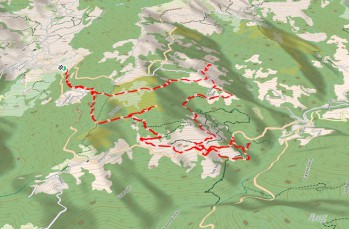
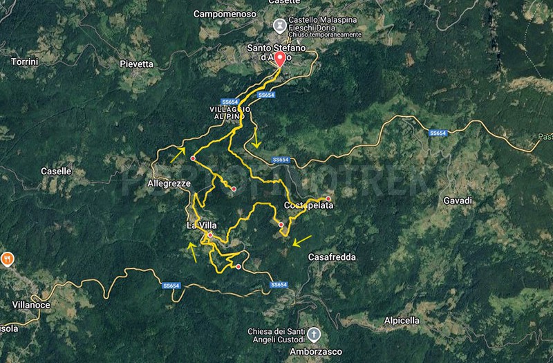
Circular trail Santo Stefano d'Aveto - Costapelata - La Villa

| Difficulty | Low |
| Duration | 3h 50' |
| Length Km | 11,900 |
| Footpath signs | |
An easy itinerary that can be walked all year round that crosses the heart of some villages in the Val D’Aveto and leads to a charming waterfall.
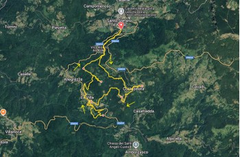
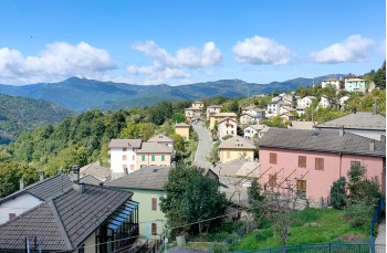
The starting point is Santo Stefano D’Aveto, a town in the Ligurian hinterland reachable in a couple of hours by car from Chiavari, also connected by a bus line.
The trailhead is at the beginning of the holiday resort, a few meters after the large building that once housed the Groppo Rosso hotel.
Below the road there is a convenient parking area.
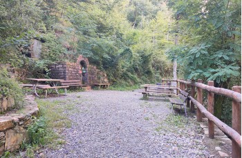
You follow the wide gravel path that proceeds flat, passing in front of the Fontanabuona spring ![]() , where some wooden benches and tables have been placed, then continue above the "Villaggio al Pino" by reaching a junction.
, where some wooden benches and tables have been placed, then continue above the "Villaggio al Pino" by reaching a junction.
Here you leave the main trail and climb left following the sign for Costapelata.
After an initial uphill stretch in the woods, you cross and ignore the path leading to Monte Maggiorasca from Allegrezze, continuing straight along the flat track.
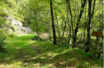
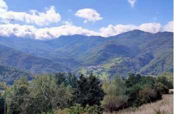
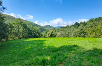
It is a pleasant woodland trail that soon begins to descend and, after crossing a small stream, continues flat next to a meadow area, offering some panoramic glimpses of Amborzasco and the valley in front.
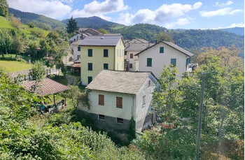
Once on the carriage road, go left to enter, passing by cultivated gardens, “case di sopra,” the restored part of Costapelata where the houses are surrounded by greenery and tranquility.
Here there is a drinking water tap.
Back on the road, descend towards Case Marolli, the more recent cluster of houses built at the beginning of the 20th century by a local family dedicated to stone extraction for construction, as evidenced by a sand mill still present; here too there is a drinking water tap.
Today the village is part of Costapelata.
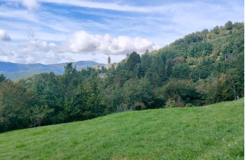
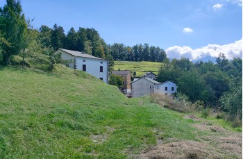
Continue past the last house along the wide gravel road that crosses woodland and then pastures, reaching after about 2 kilometers above La Villa, another well-kept hamlet of Santo Stefano D’Aveto worth exploring.
Once you reach the provincial road via one of the several side lanes, turn left downhill until, in front of the first house of the village, you find a path descending to the right.
There are no trail markers but the track is clearly visible and descends to a large meadow named Piana dei Roncazzi.
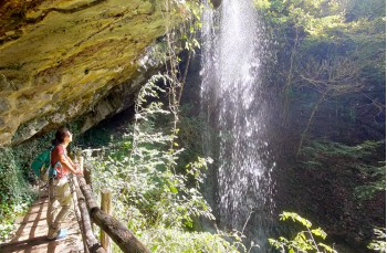
From here, continuing left, you start seeing wooden signs indicating the "Cascata del Cucù", which can be reached in about 10 minutes by descending along the grassy track, equipped in the final stretch with a wooden handrail.
With a short stepped section, you reach the wooden footbridge that takes you right under the sulfurous thermal waterfall, offering a very suggestive viewpoint.
Climb back up to the junction to continue this time to the right and after few meters on the left, following the official route with CAI markers ![]() which, through the woods, in a few minutes leads back to the SS 654, slightly lower than where you descended earlier.
which, through the woods, in a few minutes leads back to the SS 654, slightly lower than where you descended earlier.
Turn left along the road, passing the lower part of the village visited before, to reach the Montesanto bar/trattoria, the only business still in operation. After a few meters, on the right, a staircase leads to the other side of La Villa, which you cross (here there is a drinking water fountain) to climb onto a gravel road surrounded by meadows and fruit trees.
When the road becomes paved and descends, continue right on the cement road that climbs, then bends right and continues into the woods.
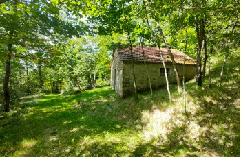
At a crossroads, continue on the uphill path, a shortcut that rejoins higher up with the main trail leading to some stone cottages.
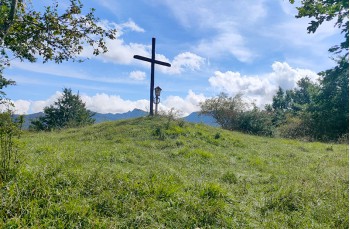
Here, if you wish, you can take a short detour to the right to climb to "Croce", a small summit where a wooden cross has been placed, marking the end of a Via Crucis route starting from Allegrezze.
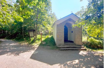
Back on the main trail, continue climbing past a house and shortly reach the Cappelletta, where there is a rest area and a a drinking water tap.
Following the signs to Santo Stefano d'Aveto, walk along the wide dirt road ![]() to reach the junction for Costapelata, and retracing the outbound route, return to the starting point.
to reach the junction for Costapelata, and retracing the outbound route, return to the starting point.
In Santo Stefano D’Aveto, very lively during the summer months, you can find open businesses and buy local products even during the low season.
Unlock, view and download the gpx track by becoming a Supporter.
Data sheet
| Difficulty | Low |
| Duration | 3h 50' |
| Length Km | 11,900 |
| Footpath signs | |