Monte Zatta circular trail


| Difficulty | Easy |
| Duration | 3h 50' |
| Length km. | 9,900 |
| Footpath signs | |
A simple loop hike, also suitable for families, which develops mainly in the shade of beech trees and woods, ideal for those who don't want to give up a walk on hot summer days.
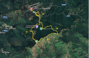
The starting point is at Passo del Bocco (956 m), a mountain pass connecting Liguria and Emilia Romagna, and the starting point of many hiking trails.
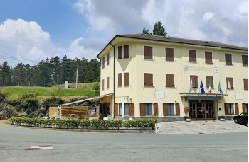
Here is located the Rifugio Antonio Devoto with rooms and a restaurant.
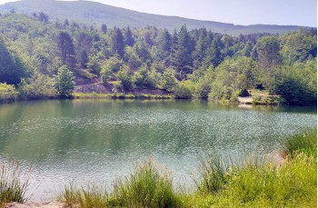
After parking your vehicle, follow SP 49, which starts in front of the refuge, then turn left a few meters past the last house and descend along the road leading to the Laghetto del Bocco (or Laghetto di Giaiette), a small artificial lake inhabited by numerous fish, well-maintained and equipped with a picnic area.
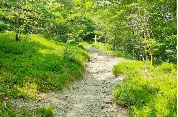
Once the lake loop is completed - in about fifteen minutes - walk a few more steps along the road, then leave it when a dirt path starts on the right, marked by the signpost of the Alta Via dei Monti Liguri ![]() and the marker of the Parco dell’Aveto, which labels this trail with A10.
and the marker of the Parco dell’Aveto, which labels this trail with A10.
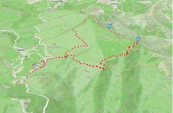
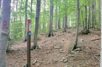
The trail ascends gently to a junction, where you continue to the left until you reach a panel with further directions. From there, enter the woods via a narrow path that climbs on the left.
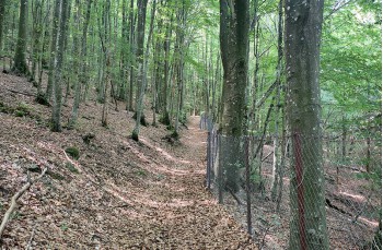
You now enter the cool beech forest, which will be the backdrop for most of the route, climbing gently with a few flatter stretches, guided by the A10 trail sign on the trees.
At a fork, stay to the left towards Monte Prato Pinello, continuing on a steeper ascent until you reach a fresh water spring where a small rest area has been created.
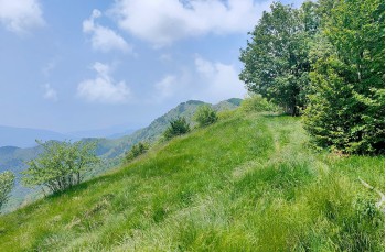
Turn right to continue the climb, which shortly ends on the green ridge overlooking the Val Graveglia.
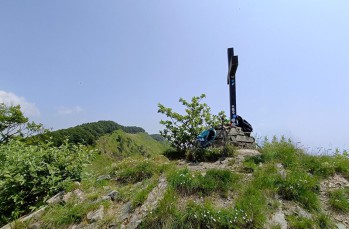
Now follow the panoramic ridge to the right, passing a sign indicating Monte Zatta di Levante, and continue, alternating between ridge line and occasional inner sections, until you spot a (non-marked) trail on the left that leads in 5 minutes to the summit of Monte Zatta Centrale, marked by a cross and offering spectacular views all around.
This is the best place along the entire route to stop for lunch.
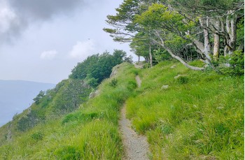
After this detour, return to the main trail and continue west, still guided by the ![]() trail sign, until you reach Monte Zatta Ponente (1355 m), recognizable by a small chapel.
trail sign, until you reach Monte Zatta Ponente (1355 m), recognizable by a small chapel.
Following the Alta Via dei Monti Liguri trail, descend into the forest via a series of switchbacks. Pay attention to a short detour on the right that leads to the "Faggio 40", a monumental tree that fell in 2005 due to a fungal infection.
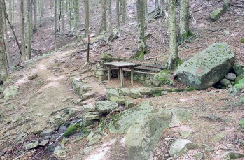
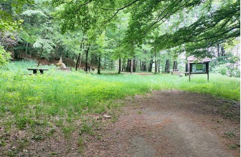
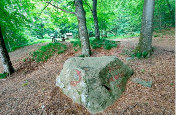
Back on the main path, continue descending until you reach a shaded flat area equipped with tables, wooden benches, and a barbecue setup, known as "Poggio Buenos Aires".
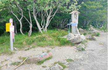
Cross the rest area, turn right and take the descending trail marked with the ![]() sign. It offers some views over the valley before entering the forest again, where another water spring can be found. Continue down to the dirt road until you reach the same junction encountered earlier.
sign. It offers some views over the valley before entering the forest again, where another water spring can be found. Continue down to the dirt road until you reach the same junction encountered earlier.
From here, continue downhill along the same route taken at the beginning to return to the starting point.
Unlock, view and download the gpx track by becoming a Supporter.
Data sheet

| Difficulty | Easy |
| Duration | 3h 50' |
| Length km. | 9,900 |
| Footpath signs | |