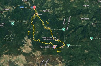
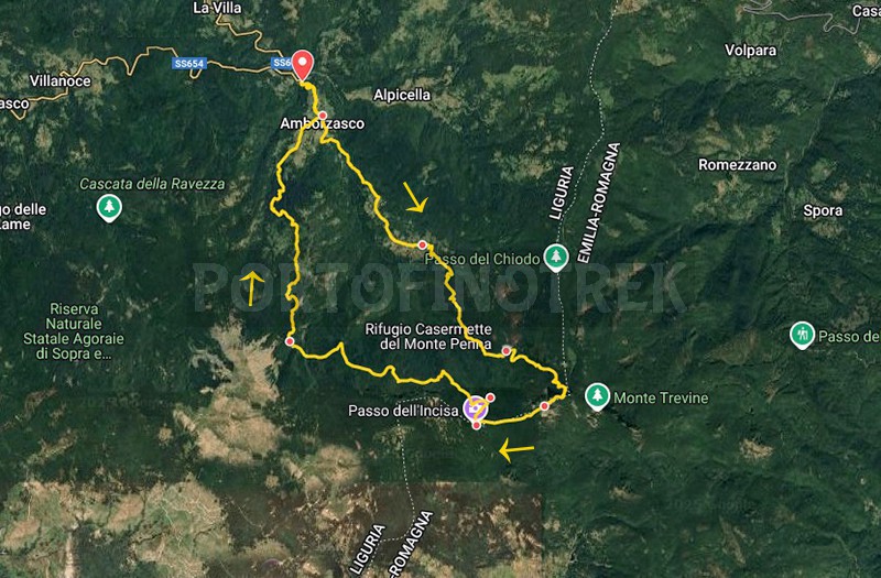
Circular trail Gramizza - Amborzasco - Monte Penna - Passo dell'Incisa - Re di Coppe


| Difficulty | High |
| Duration | 6h 30' |
| Length Km | 17,500 |
| Footpath signs | |
Challenging itinerary to complete the loop of Monte Penna, starting from Gramizza, a small cluster of houses with a few services: a grocery store/bar "Fontana e Fugazzi", renowned for its charcuterie boards and sandwiches; the farm "Mulino di Gramizza", where you can buy flour and potatoes; and the agritourism "La casa nel bosco".
Due to the initial elevation gain and an exposed section equipped with chains, classified as EE (for Expert Hikers), proper preparation is required and, in any case, it is not recommended to attempt it in bad weather. Make sure in advance that there is no snow.
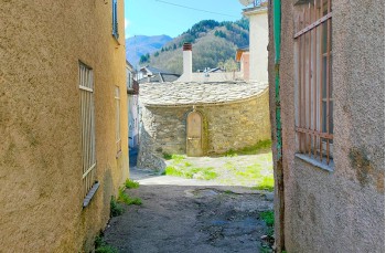
Gramizza, located along the SS 654, can be reached from Chiavari by bus or by car in about 1 hour and 30 minutes either from Chiavari or from Val Fontanabuona, passing through the Scoglina Pass.
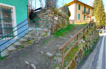
A small roadside area allows parking and makes it easy to spot, directly opposite, the clear signs to start the hike.
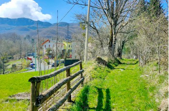
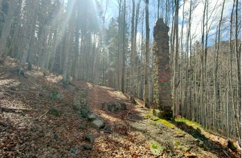
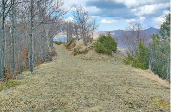
The trail climbs ![]() and in about 20 minutes leads, via a mule track that cuts across the road, to the green meadows surrounding the welcoming village of Amborzasco, the largest hamlet of Santo Stefano D’Aveto, which we recommend exploring briefly, even though the trail sign points to the paved road.
and in about 20 minutes leads, via a mule track that cuts across the road, to the green meadows surrounding the welcoming village of Amborzasco, the largest hamlet of Santo Stefano D’Aveto, which we recommend exploring briefly, even though the trail sign points to the paved road.
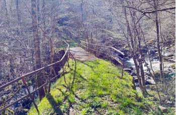
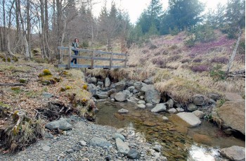
At the end of the village, the provincial road 75 is rejoined and followed to the right until a charming stone chapel below the road appears, where the trail descends into the forest. After crossing a small bridge over the stream, it climbs towards Casoni di Amborzasco, a small village divided into three clusters connected by a mule track that intersects the road several times.
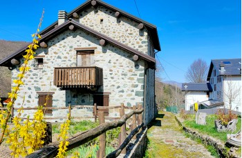
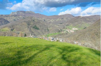
The view is impressive: small houses, some still made of bare stone, nestled among endless meadows, woods, and surrounding peaks.
A water spring is available in the second group of houses.
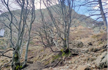
The FIE trail marker ![]() follows the paved road for a stretch, then turns right into a beech forest, where one should always watch for the trail signs, which in some areas are faded.
follows the paved road for a stretch, then turns right into a beech forest, where one should always watch for the trail signs, which in some areas are faded.
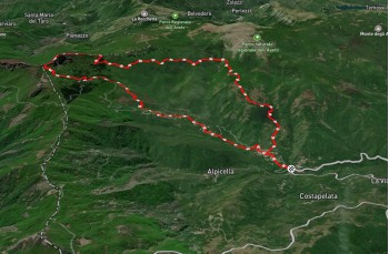
The trail gently ascends until signage indicates a left turn, leading to a steeper and more continuous climb inside the Monte Penna Forest, eventually crossing the provincial road that soon reaches the Casermette del Monte Penna Refuge (about 2 hours from the start), a rest and overnight stop (always check in advance if it's open).
From the refuge (1392 m), continue straight along the road until spotting the wooden sign pointing to "Monte Penna" and the trail marker ![]() , which shortly leads to a junction where a Parco dell’Aveto signpost indicates a left turn, with a walking time of 1 hour.
, which shortly leads to a junction where a Parco dell’Aveto signpost indicates a left turn, with a walking time of 1 hour.
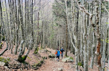
Keeping an eye on the same trail marker ![]() , you walk through a beautiful beech forest scattered with moss-covered boulders, which offers refreshing shade in summer and spectacular colors in autumn.
, you walk through a beautiful beech forest scattered with moss-covered boulders, which offers refreshing shade in summer and spectacular colors in autumn.
After a mostly flat section, a gentle ascent leads to a trail intersection with signs pointing to the right. The ascent becomes steeper here and, in some winter months, may be more difficult due to icy snow.
At the junction, for Monte Penna continue to the right, still following the trail marker ![]() .
.
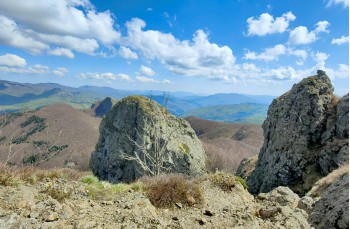
The trail climbs a few more meters through the forest, reaching the Monte Penna saddle, which separates Monte Penna on the left from Pennino on the right, offering a preview of the stunning views enjoyed at the summit.
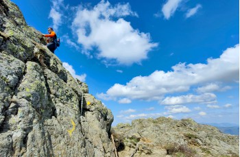
This is the most thrilling yet challenging section, requiring great caution and attention: with the help of chains—and occasionally your hands—you climb the rocky ridge to reach the summit of Monte Penna (1735 m) in about 10 minutes, which marks the border between Liguria and Emilia Romagna.
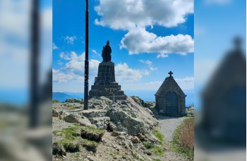
The summit offers breathtaking views of the Ligurian Apennines, the Apuan Alps, and, on clear days, even the coastline and sea. It features a statue of the Virgin Mary and a small chapel—an ideal spot for a lunch break before continuing.
To descend, follow the trail marker ![]() , which leads through a pleasant forest path to the dirt road at Passo dell’Incisa in about 30 minutes, where several trails intersect.
, which leads through a pleasant forest path to the dirt road at Passo dell’Incisa in about 30 minutes, where several trails intersect.
Our itinerary continues to the right toward the Casermette del Penna Refuge for about 450 meters until reaching the Segheria del Penna, where you leave the main road and keep to the left.
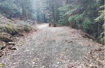
This puts you on the Aveto Park A4 loop trail. There are no additional trail markers, but it's easy to follow as it's a wide dirt road that initially runs flat through the forest, then descends, offering occasional panoramic views.
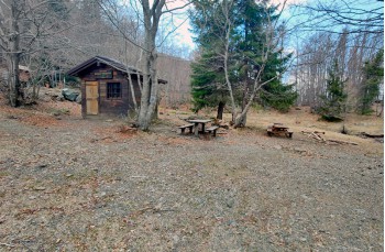
After 3.5 kilometers, you reach the area called Re di Coppe, where the Moglia Negretta shelter stands—a small wooden hut available to hikers, surrounded by a lovely clearing.
Leaving the shelter on the left, cross a small stream and follow the trail marker ![]() to cross the forest before beginning the descent, along a beautiful mule path bordered by low Mediterranean scrub, with sweeping views of the surrounding peaks.
to cross the forest before beginning the descent, along a beautiful mule path bordered by low Mediterranean scrub, with sweeping views of the surrounding peaks.
Along the descent, you'll pass a small picnic area with wooden tables and a curious outdoor stove for cooking.
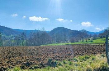
As you approach Amborzasco (about 1 hour from the shelter), the landscape becomes particularly appealing: endless green meadows with the main peaks of the Val D’Aveto in the background.
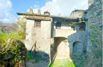
After passing a lovely stone chapel, you descend into the village center, where some characteristic houses stand out, such as "Cà da grattura", a house located at the entrance of the village that once served as a control post.
Near the church, follow the paved road until meeting, on the left, the same trail taken at the beginning, which leads back to Gramizza.
Unlock, view and download the gpx track by becoming a Supporter.
Data sheet
| Difficulty | High |
| Duration | 6h 30' |
| Length Km | 17,500 |
| Footpath signs | |