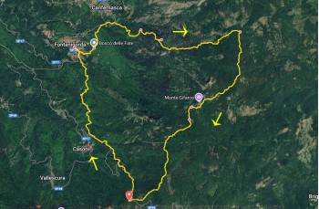
Circular trail Passo di Fregarolo - Fontanigorda - Passo Esola


| Difficulty | Low |
| Duration | 6h 20' |
| Length Km | 15,300 |
| Symbole | |
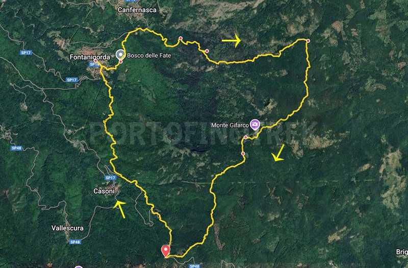
A beautiful hiking route that stretches between Val D’Aveto and Val Trebbia, recommended especially during the summer months as a way to escape the coastal heat.
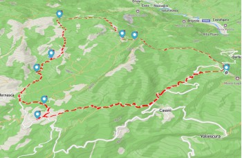
The hike starts at Passo di Fregarolo (1203 m), which can be reached from Chiavari in just under two hours by car. Follow the SP586 to the village of Cabanne, then turn left onto the SP48. There’s a convenient parking area at the pass, where you’ll also find a small restaurant, "Trattoria al Valico".
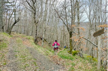
Clear wooden REL signs (Ligurian Hiking Network), marked "Strada di Chiavari" ![]() , lead to a path that passes by the only house in the area and enters the forest.
, lead to a path that passes by the only house in the area and enters the forest.
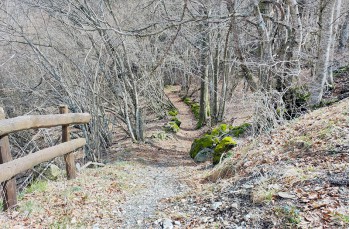
The well-marked and maintained trail gently descends through the woods, crossing the dirt road at several points—sometimes briefly following it—before returning to the trail, with frequent signs showing walking times.
Near the small village of Casoni, visible down to the left, the trail leaves the paved road for the last time and climbs back into the forest. It passes a spot marked by a small cross, "Cruxetta d’aia pian-a", once a station for processions seeking forgiveness and blessings for the crops.
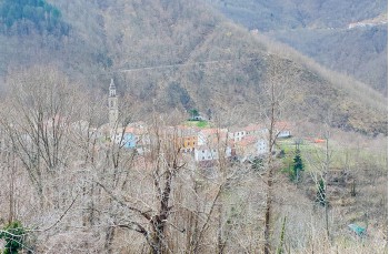
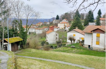
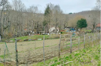
Shortly after, the path descends to a solitary rustic house in the woods, where it continues to the right along an old mule track leading to a meadow. This signals your entrance into the heart of Fontanigorda (819 m), a village in Val Trebbia that is peaceful and quiet in winter but livelier in the summer, when many vacationers from Genoa arrive.
Here, you can refill your water bottles at one of the many fountains—giving the village its name. Fontanigorda also offers options for food and overnight stays.
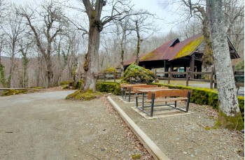
After a recommended visit to the village, return to Piazza Roma and continue into Parco Villette, where the path climbs towards the enchanting "Bosco delle Fate" (Fairy Forest)—a shaded play area for children beneath centuries-old chestnut trees, also home to a recreation center.
Along the way, you'll find slate slabs engraved with verses by Giorgio Caproni, the poet who deeply loved Fontanigorda and dedicated one of his early works to it: "Ballo a Fontanigorda".
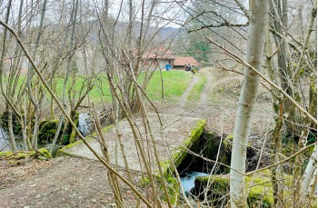
From the bowls game court, follow signs for Strada di Chiavari and ![]() to descend into the woods. After about 20 minutes, you’ll reach the paved road in the area called Mulino, where you can admire an old mill on the left.
to descend into the woods. After about 20 minutes, you’ll reach the paved road in the area called Mulino, where you can admire an old mill on the left.
Follow the SP18 to the right for about 300 meters, then leave the road just before reaching Canfernasca, climbing into the woods on the right. This time, follow the FIE trail marker ![]() .
.
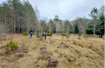
The trail ascends through clearings, woods, and flat areas where water seeps from the ground, eventually reaching the locality Pianelli. A steeper ascent leads to a fork, where a very short detour to the left is recommended to visit Lago Margotta (1250 m).
Although the lake has mostly turned into a peat bog, it’s a peaceful spot near the halfway point of the hike—ideal for a lunch break.
Return to the fork and continue climbing along a narrow trail carved by water, which turns into a scenic mule track and leads to a plateau. Cross it and climb again through the forest, following a stream, until you reach Passo di Esola (1304 m), a mountain pass connecting Val Trebbia and Val D’Aveto.
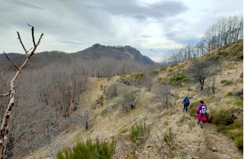
This pass is a crossroads of trails. Our route continues to the right (heading straight down would lead to Rezzoaglio in about two hours), following the trail marker ![]() , which enters a beech forest and later emerges onto a ridge, continuing flat for a while.
, which enters a beech forest and later emerges onto a ridge, continuing flat for a while.
Ignore the trails branching off to the right—one leading to Monte Roccabruna, the other to Monte Gifarco, the prominent peak ahead—and continue toward Passo del Gifarco.
From there, descend again until reaching the fork at Passo del Fante, then continue straight on a gentle uphill stretch through the woods.
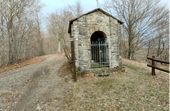
The trail winds through the beech forest, with alternating ascents and descents, before a final climb and descent to the small chapel at Passo del Fregarolo, completing this scenic loop trail.
Unlock, view and download the gpx track by becoming a Supporter.
Data sheet
| Difficulty | Low |
| Duration | 6h 20' |
| Length Km | 15,300 |
| Symbole | |