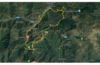
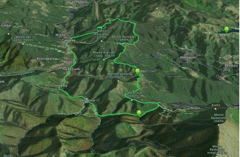
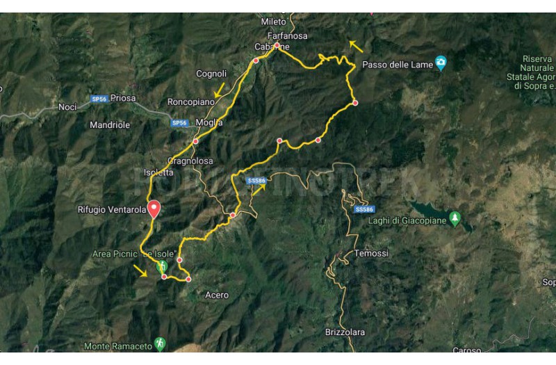
Trail Ventarola - Passo della Forcella - Farfanosa - Cabanne - Parazzuolo

Difficulty Medium
Duration 5h 50'
Length Km 18,100
Footpath signs Triangolo giallo + Alta via monti liguri + +
Dislivello805m - 1190m | dislivello positivo 688m | dislivello positivo 688m
StartStarting point
Passing through

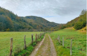
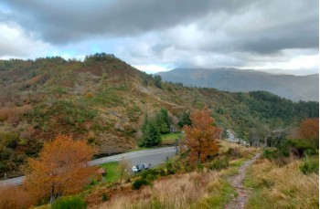
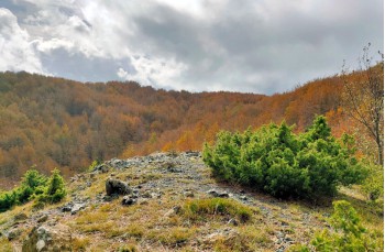
An unusual but rewarding circular itinerary in Val D'Aveto, following a section of the Alta Via dei Monti Liguri and the Sentiero Italia, especially recommended in summer when the heat and humidity along the coast drive trekking enthusiasts to the cooler inland areas of Liguria.

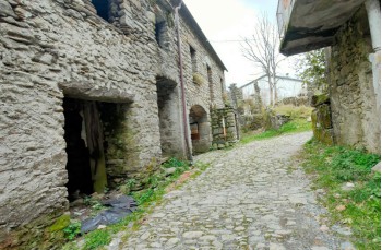
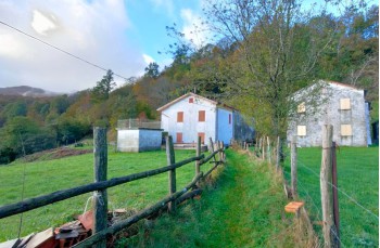
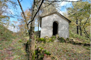
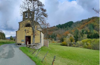
The journey begins in Ventarola, a hamlet of Rezzoaglio reachable by car in about an hour from Lavagna or Chiavari, following the Provincial Road 586 of Val D'Aveto; alternatively, there's a public bus service from Chiavari to Santo Stefano D'Aveto that stops in Parazzuolo, from where you can continue on foot for 2 km.

You pass through the medieval stone houses of the Ventarola village, some abandoned and others renovated, reaching a wooden bridge that crosses the Ventarola stream, continuing along a plain to encounter a second bridge over the Liciorno stream.

After about 20 minutes, you reach the Quadrivio di Crocetta intersection, recognizable for the "Le Isole" picnic area. Our itinerary continues to the left on a dirt road, reaching the Passo della Crocetta after about 200 meters.

Always keeping to the left, cutting a stretch of dirt road found just above, the path continues flat until you reach Case Acero, few houses surrounded by lush green meadows. You follow the path along the meadows and then through the woods, covering a pleasant 2 km route with gentle ascents and panoramic views of the surrounding valleys. A final descent leads to Passo della Forcella (875 m above sea level) on SS 586, where a small chapel is located.

After crossing the road and passing by the war memorial, follow Stage 32 of the Alta Via dei Monti Liguri. In the first part of the route, some brief passages may be covered with tall grass and some brambles, but as you ascend, the path becomes clean and scenic, following the ridge that separates Valle Sturla and Val D'Aveto.

The ascent becomes noticeable as you cross a beautiful forest, arriving at the slopes of Monte Bozale nord. Pay attention to the trail marker to avoid taking the path descends to Cabanne. Instead, continue east to reach Passo del Bozale (965 m above sea level), where a small chapel stands. Before the construction of the highway, it served as a refuge for those traveling the mule track from Chiavari to Val D'Aveto.

Its structure still provides shelter from the weather, and the wooden table and bench behind the structure are perfect for a rest stop. The Passo is a crossroads of trails; our itinerary continues in the beech forest, heading towards Versante Sud Monte Fascia, another important intersection where the Alta Via dei Monti Liguri, the Sentiero Italia, and the Cammino di Assisi intersect.

Now, leave the path that ascends to Passo delle Lame and start descending, following and CAI trail markers .

In particular, the trail marker is consistently present, guiding you through the descent in the woods, not always intuitive. If too much time passes since the last marker, you're probably off the track, and we recommend turning back to find it.

Arrived at a large deforested area, where wood is collected, keep to the left and try to identify, always guided by the same trail marker, the path that re-enters the woods. Continue descending, always keeping an eye on the trail marker , crossing streams several times, to reach Provincial Road 856, on the border between the localities of Farfanosa and Cabanne.

Cross the bridge over the Aveto and then leave the provincial road, turning left onto the road that passes through the ancient village of Cabanne, where the parish church of San Bernardo is located. In Cabanne, on the main road, there are a couple of restaurants as well as agricultural companies selling local products.

The route briefly returns to the main road before re-entering and, following the stream, crosses vast green expanses where grazing animals can be seen. Continuing straight, you reach the village of Parazzuolo.

In autumn/winter, when the stream is swollen and crossing is problematic, if not impossible, it is advisable to return to the main road near the borgo di Moglia (just before Parazzuolo), even if this involves a short passage on private land.

From Parazzuolo, travel the 2 km leading to Ventarola, the starting and ending point of this itinerary.

The path on Google Map

Unlock, view and download the gpx track by becoming a Supporter.

Data sheet

Time
From 5h to 7h
Length Km
15 - 20
Difficulty
Medium

Download

Download is reserved for Portofinotrek supporters.

You can support us by becoming one of our Supporters.
A great little help that will allow you to access all the contents of the site.

Learn more.

Are you already Supporter?
Log in now