Circular trail Larvego - Monte Ramaceto - Fo' de Driun - Prati di Cichero


| Difficulty | Medium |
| Duration | 4h 00' |
| Length km. | 9,300 |
| Footpath signs | |
Loop itinerary in Val Cichero, also known as Val Cicana, with an ascent to Monte Ramaceto, accessible all year round
The starting point, the hamlet of Larvego, where the agriturismo "Cason du Larvego" once stood, can be reached from Carasco either by following State Road SS 225 of Val Fontanabuona to Piano Officioso and then turning right onto Provincial Road SP 42 passing through Passo di Romaggi, or by taking SP 586 to Terrarossa and continuing left on SP 42.
After parking along the road, a few metres further on (coming from Terrarossa), just past the stone houses, the start of the trail can be seen on the right as it climbs into the woods, marked with the trail sign ![]() .
.
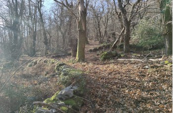
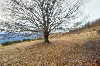
In the first section, apart from a short more open stretch, the route runs entirely through a beautiful chestnut forest, where several large specimens stand out, alternating gentle climbs with level sections characterised by rocky outcrops that border the path.
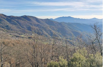
The trail then continues through Mediterranean scrub, offering occasional views over the valley, and reaches a fork where, following the markings on the rock, you keep right, now following the trail sign ![]() .
.
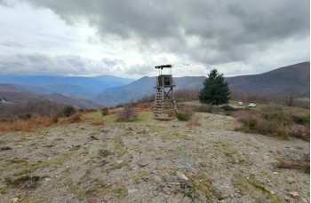
You proceed on a gentle ascent, accompanied by views of the summit of Monte Ramaceto and the ridgeline, until reaching a second junction at Passo del Dente, where the path coming up from Costa di Soglio meets the one descending from Monte Mignago.
Still following ![]() , continue straight on the trail which, after passing through a section with crumbling sandstone slabs, enters a small woodland and, with a series of ups and downs, reaches the third junction at Pian dei Baci.
, continue straight on the trail which, after passing through a section with crumbling sandstone slabs, enters a small woodland and, with a series of ups and downs, reaches the third junction at Pian dei Baci.
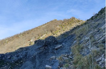
Here you leave the 7 Passes itinerary, which continues straight and level, and instead tackle the steep climb to the right toward the summit of Monte Ramaceto. The summit is reached after about an hour, along a trail that initially cuts through the woods and then continues across an open clearing, where it is advisable to follow the trail markers and stone cairns to avoid losing the path.
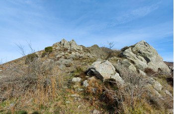
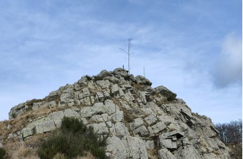
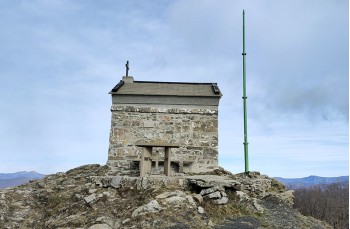
After one last rocky section, a small statue of the Madonna marks the arrival at the western summit of Monte Ramaceto (1318 m), where a small stone chapel stands, which can provide excellent shelter if needed.
The scenery welcoming hikers at the summit invites a stop for lunch or simply to admire the panorama.
Leaving the chapel behind, continue along the ridge following ![]() , on an undulating route that partly re-enters the forest, where a Roman-era boundary stone was discovered a few years ago.
, on an undulating route that partly re-enters the forest, where a Roman-era boundary stone was discovered a few years ago.
You soon reach the base of the main summit of Monte Ramaceto (1345 m), less frequented as the view is obscured by beech trees, but which can be climbed in a few minutes before descending on the other side to rejoin the Alta Via dei Monti Liguri.
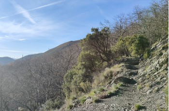
The route now follows the ridge, overlooking Val Cichero, with some narrow passages over rocky terrain, descending to Fo' de Driun and shortly afterwards to a junction where you leave ![]() leading into Val d’Aveto, to follow the trail on the right marked with
leading into Val d’Aveto, to follow the trail on the right marked with ![]() .
.
You now descend quickly through the woods for about 500 metres, reaching a flat area where you turn right toward an imposing tree on which the (not very visible) trail FIE sign ![]() appears, guiding you to the Prati di Cichero.
appears, guiding you to the Prati di Cichero.
This final stretch of the route is entirely downhill, initially across meadows and then, with tight switchbacks, over gravel, always accompanied by views of the valley.
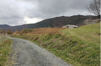
You cross a small stream, pass through an area covered with ferns, and after about 40 minutes from the junction reach the vicinity of a wooden structure and the parking area at Prati di Cichero, where two benches with a wooden table have been placed under the shade of a majestic tree.
From here, if desired, you can reach the Pria scrita in about 1 hour round trip (see below).
You then follow the gently descending road that runs through the meadows for about one kilometre, arriving at Larvego, the starting point of the hike.
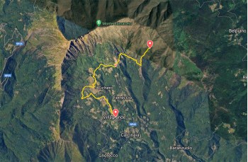
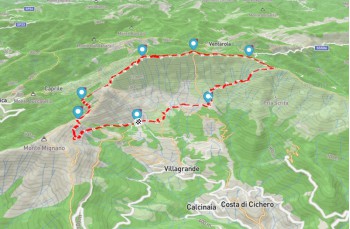
The path tracked on Google Maps
Unlock, view and download the gpx track by becoming a Supporter.
Data sheet
You might also be interested in

| Difficulty | Medium |
| Duration | 4h 00' |
| Length km. | 9,300 |
| Footpath signs | |