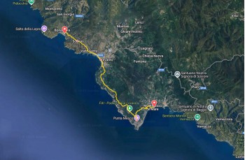
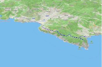
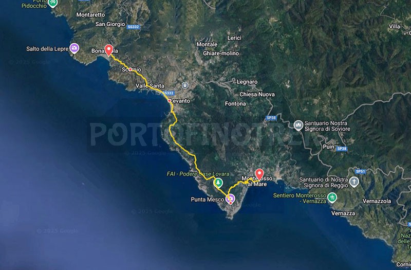
Trail Bonassola - Levanto - Monterosso


| Difficulty | Easy |
| Duration | 3h 30' |
| Length km. | 10,500 |
| Footpath signs | |
A spectacular hike from a scenic point of view that we recommend doing in the low season months to avoid crowds and excessive heat.
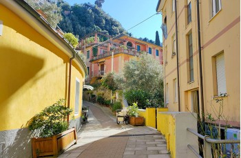
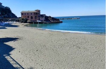
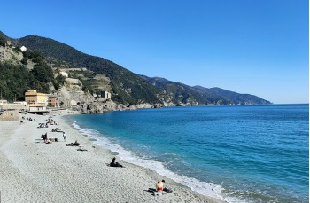
The starting point is Bonassola, a quiet town in La Spezia province that comes alive at the beginning of the Spring season due to the presence of numerous tourists attracted by its beautiful beaches.
The most practical way to reach the Ligurian village is by train; otherwise, by car, you can exit at the Deiva Marina toll booth and drive 20 kilometers (in high season, parking is not free).
The hike begins with a walk along the seafront towards the east until you reach, on the left, Via Cristoforo Colombo, a street that leads into the town. After passing the municipal building, you will find the start of the trail on the right, easily identifiable by the CAI trail marker ![]() and the Sentiero Liguria marker
and the Sentiero Liguria marker ![]() , the walking route that connects the entire Liguria region from Ventimiglia to Bocca di Magra.
, the walking route that connects the entire Liguria region from Ventimiglia to Bocca di Magra.
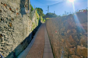
Ascending through the houses, you reach Poggio on the provincial road, which you walk to the right for a few meters until you find a concrete staircase on the left continuing upwards, quite steep, briefly crossing the paved road before continuing uphill to hamlet Scernio.
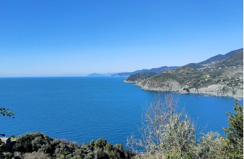
Here, you cross the road to continue on the trail, which, after passing the last houses, becomes particularly scenic, set between the green hills and the blue sea.
After a flat section, the descent towards Levanto begins, always on a rocky path that, after about 15 minutes, ends at Via Vallesanta on a paved road. Follow it to the left for a few steps before taking the long staircase on the right, which, cutting across the road in two places, leads more quickly into the village.
Head east to walk along the beautiful and long seafront promenade of Levanto, a town offering all kinds of services, as well as bars, shops, and restaurants.
At the end of the promenade, beneath a beautiful stone villa with blue window frames, pass under the archway to find signs for the trail leading to Monterosso.
The trail markers remain the same: Sentiero Liguria ![]() and CAI trail marker
and CAI trail marker ![]()
A staircase begins the climb leading to Castello San Giorgio, built in the second half of the 16th century in a strategic and panoramic position. However, it is currently not open to visitors as it is privately owned.
Keeping to the right, continue climbing past some houses before proceeding on the trail, which ascends with stunning views over Levanto and, further ahead, the Portofino promontory.
Upon reaching Via Mesco, a paved road, follow it uphill for about 200 meters until reaching a hotel on the sea side, where the trail marker directs you to leave the asphalt and continue to the right on a narrow dirt path, mainly level, offering spectacular views of the gulf.
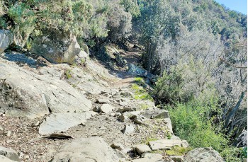
Entering the holm oak forest, the ascent resumes, at times steep, characterized by switchbacks and wide, rudimentary stone steps that facilitate the climb until reaching a rocky outcrop overlooking the sea.
From here, the path continues on rocky terrain surrounded by Mediterranean scrub, leading to an interesting site, Podere Casa Lovara, a seaside agricultural estate restored by FAI, which has rehabilitated its buildings and terraces, making them cultivable again after years of neglect.
The climb continues until a fork where signs indicate the route to Monterosso, passing through Punta Mesco, reached in about 20 minutes by taking a short right detour at the intersection.
The area hosts the ruins of the Hermitage of Sant'Antonio del Mesco, a religious building dating back to the 1300s, and the Mesco Signal Station, used by the military during World War II and now completely abandoned. However, the main attraction is the incredible landscape view from the point, offering a unique panoramic view of all 5 Terre.
Returning to the fork, follow the signs to Monterosso to begin the long descent over rocky terrain and high steps that require some caution but provide incredible viewpoints over Monterosso and the coastline.
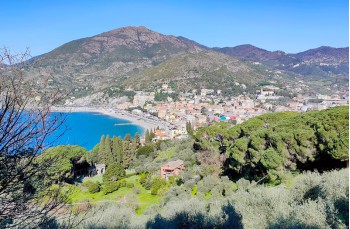
The trail ends at the roadway, which descends onto Via IV Novembre, the street to follow to the right to reach the westernmost part of the first and largest of the five villages that make up the "Cinque Terre".
Monterosso, divided by a promontory into a residential area and a historic center, is a lively and welcoming town with a long coastline and numerous commercial and hospitality establishments.
The town is well served by trains, making the return to Bonassola very easy.
Unlock, view and download the gpx track by becoming a Supporter.
Data sheet
| Difficulty | Easy |
| Duration | 3h 30' |
| Length km. | 10,500 |
| Footpath signs | |