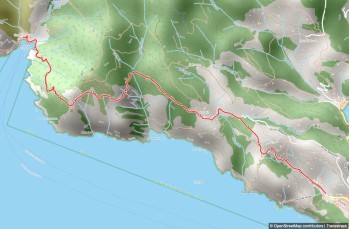
This straightforward yet scenic trail links three gems of the Tigullio: Santa Margherita Ligure, Paraggi, and Portofino. Start at Santa Margherita, near the marina entrance behind the petrol station. Head up Via Montebello, a paved road winding through houses for about 300 meters before it becomes a mule track. After roughly 20 minutes, passing through terraced fields, you'll reach the Cappella della Madonna della Neve in Nozarego.
From here, walk 100 meters on the asphalt road until you find a cobbled path on your left. This path climbs between villas with gardens and dry stone walls, quickly joining the road from the church of Nozarego. Continue on level ground with views of the Gulf and the Abbazia di Cervara.
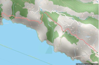
You'll arrive at Cappelletta delle Gave, named for its small church and a junction for many trails. There's a drinking water tap here. Take the steep path descending beside the chapel, paved with cobblestones, winding between terraces and glimpses of beautiful villas through gates. After a short flat section, descend again via a concrete stairway between high walls, ending at Paraggi near a hotel.
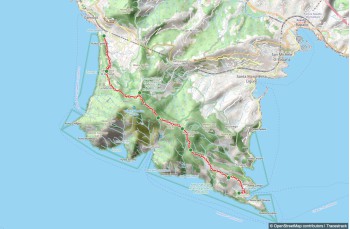
Follow the road to the right for a few meters, then take the staircase on the right leading to the Paraggi-Portofino pedestrian path, known as Via dei Baci. This well-maintained trail runs parallel to the road, fully immersed in greenery. After some gentle ups and downs and stunning views of the bay, the path mostly levels out, passing several villas with increasingly impressive views of Portofino.
You'll reach Italy's most famous village in about 20 minutes, arriving at the parish church of San Martino, noted for its yellow and gray stripes. From here, descend into the village center to experience its luxury and charm.