- Out-of-Stock
Portofino Vetta - Portofino mare


| Difficulty | Low |
| Duration | 1h 50' |
| Length Km | 5,650 |
| Footpath signs | |
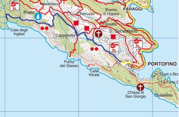
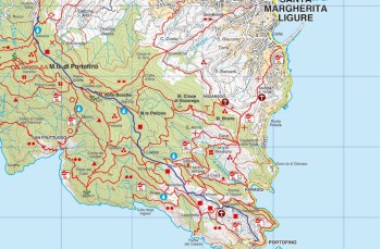
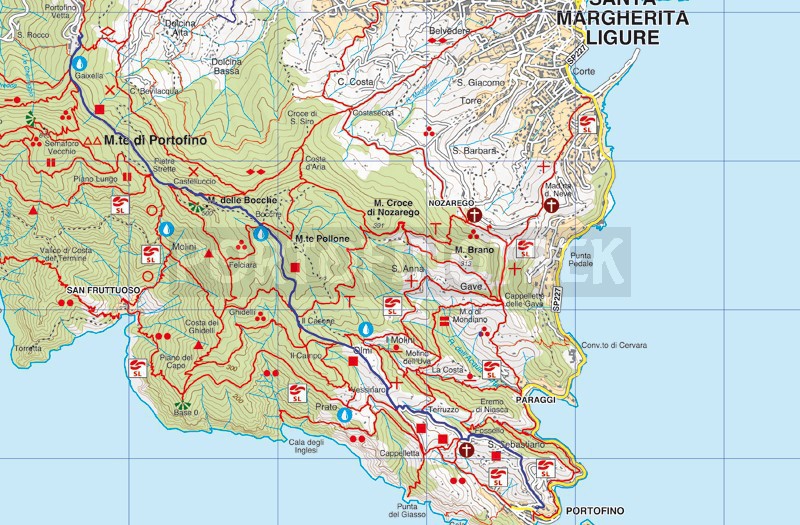
The Portofino Vetta - Portofino Mare itinerary, considered one of the main routes in the "Parco di Portofino," traverses the entire promontory from northwest to southeast.
The trail begins at Portofino Vetta, with the park entrance behind the Hotel (alternatively, there's also an entrance in front of the car park). The trail continues easily, passing through the locations of Gaixella and, after 15 minutes, Pietre Strette.
Both are equipped as rest points with tables, benches, and a drinking water tap.
Continuing on the main path shaded by large chestnut trees, the route proceeds on a relatively flat terrain with gentle slopes, reaching the Bocche location. This is another rest point and a crossroads for numerous trails (turn left for Monte Pollone and Santa Margherita Ligure, turn right to reach Felciara, Base O, San Fruttuoso). Here, you'll find another drinking water tap.
The wide gravel and stone path continues its descent, intersecting several turnoffs for other paths. After about 15 minutes, at Crocetta, a left turn leads to Nozarego and a right turn leads to San Fruttuoso. After another 5 minutes, at Il Casone, there's another junction for the San Fruttuoso mule track. Two minutes later, where the road becomes drivable*, a sign indicates that a left turn leads to Nozarego and the Mulino di Gassetta refreshment point.
The landscape changes, the sea begins to come into view, and the trail winds through the first villas with well-kept gardens, reaching the Olmi location, where the last turnoff for Nozarego starts.
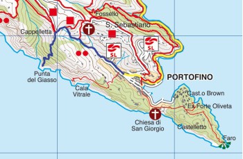
Continuing straight, the path arrives at a rest point equipped with benches. Apart from the turnoff to San Fruttuoso, there are two options to descend to Portofino: turn left (![]() ) or go straight (
) or go straight (![]() ).
).
Turning left, the well-maintained but quite steep road descends amidst terraced fields to the San Sebastiano location, characterized by a beautiful chapel and a small cluster of houses.
The path, becoming progressively steeper, passes through the locations of Fossello (with a left turn leading to the Valle dell'acqua viva) and Pino (with a right turn indicating an agriturismo) as it descends towards the village, offering enchanting views of the Paraggi bay.
Castello Brown, the Church of San Giorgio, and finally, the famous "Piazzetta," are the first sights of Portofino as you approach the parish church, where the itinerary concludes.
*Section of road accessible to local residents with motorcycles, scooters, and small private vehicles, please be cautious.
Unlock, view and download the gpx track by becoming a Supporter.
Data sheet
You might also be interested in
| Difficulty | Low |
| Duration | 1h 50' |
| Length Km | 5,650 |
| Footpath signs | |