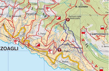
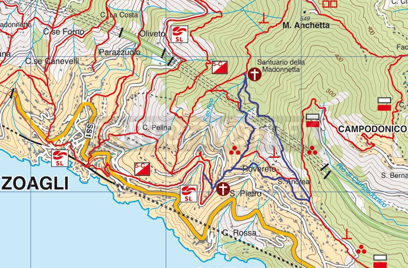
San Pietro di Rovereto - Santuario della Madonnetta - Sant'Andrea di Rovereto

| Difficulty | Low |
| Duration | 1h 40' |
| Length Km | 3,600 |
| Footpath signs | |
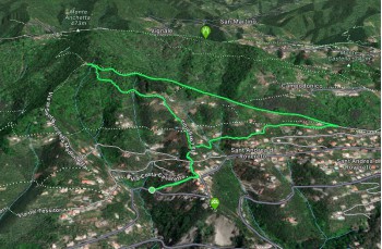
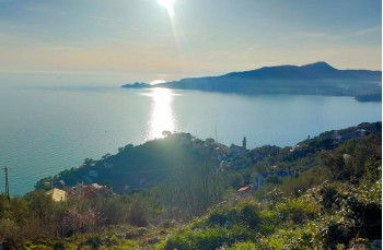
A short and undemanding itinerary between the Municipalities of Zoagli and Chiavari, suitable for an afternoon outing with a snack break at the Sanctuary of Madonnetta and a descent with a sunset view over the Gulf of Tigullio.
The starting point is in San Pietro di Rovereto, a hamlet of Zoagli accessible on Via San Pietro, the road that, shortly after the gas station, ascends to the left.
Our itinerary begins just before the village, where a small indentation allows parking (not always easy to find parking place near the church) in front of Salita Montà, the steep path that leads to the church in a few minutes.
From here, as well indicated by the Zoagli Municipality signpost, follow the staircase to the left of the church which ascends decisively, crossing Via dei Tessitori, and continue uphill to a junction, near a residence.
The trail marker that will guide you to the Sanctuary is ![]() .
.
Continue uphill along the path passing through dry stone walls and terraces until you reach Via Longarola, a steep cement staircase with views of the sea, and walls of beautiful villas.
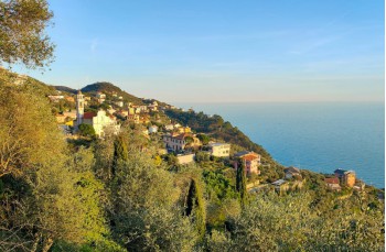
Upon reaching a small cluster of houses with a small votive shrine placed on a rock, take a moment to admire the panoramic view stretching from Sestri Levante to the Portofino promontory.
Now the trail turns left, passes the last house, and enters the forest, progressing on a flat path and then ascending gently, merging with the trail from Chiavari to reach the Sanctuary of Madonnetta (15 minutes from the junction), built in 1847 by the inhabitants of San Pietro as a thanksgiving for surviving a cholera epidemic.
The church square and some tables in the woods make it an ideal place to rest.
To return, descend the staircase taken on the way up but at the junction, keep left to descend into the woods following the FIE trail marker ![]() .
.
The trail, occasionally a bit uneven, ends after about 15 minutes on a cement road that must be followed downhill, ignoring the first left deviation and turning right at the junction near a beautiful stone house.
Now the route follows a dirt road through a typically agricultural territory, where houses, surrounded by Ligurian terraces, overlook the Gulf of Tigullio.
At the end of the dirt road, on the left, take the trail that quickly leads to the junction where, making a left turn, you can descend to see the Church of Sant' Andrea di Rovereto in the Municipality of Chiavari, dating back to the late twelfth century.
Back on the trail, continue straight until you reach the house encountered on the way up at the junction. Here, turn left retracing the same path which leads back to the church and, along Via Montà, to the starting point.
Alternatively, descending along the drivable road from the church, there is a small grocery store with an attached bar/wine shop.
Unlock, view and download the gpx track by becoming a Supporter.
Data sheet
You might also be interested in
| Difficulty | Low |
| Duration | 1h 40' |
| Length Km | 3,600 |
| Footpath signs | |
