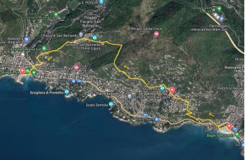
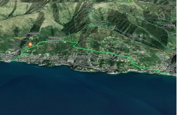
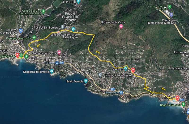
Sori - Pieve Ligure - Bogliasco

| Difficulty | Low |
| Duration | 1h 40' |
| Length Km | 4,300 |
| Footpath signs | |
A simple yet rewarding itinerary that connects the three renowned destinations of Golfo Paradiso through typical Ligurian creuze (ancient mule tracks) and scenic trails.
The starting point is Sori, a peaceful seaside village easily accessible by train or private vehicles, offering a variety of bars and restaurants.
The itinerary begins facing the sea on Via Cavour, heading west towards the Sanctuary of N.S delle Grazie, then continuing left along the oratory of Sant'Erasmo. Here, there is a tap with drinkable water.
Staying on the same street, you ascend among houses, including one where Pablo Picasso's great-grandfather was born, to reach Via Aurelia.
Crossing it, follow the FIE trail marker ![]() located to the right on Via Manin after a few meters.
located to the right on Via Manin after a few meters.
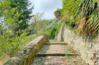
Climb among beautiful residences until you reach a drivable road, where you keep left on Via San Gaetano, a typical Ligurian mule track (creuza) made with bricks and pebbles, ascending gently.
Continuing straight, there is no chance of getting lost, even when you reach a yellow chapel with a fork; keep right on the same path.
When Via San Gaetano becomes drivable, leave it and ascend straight on the staircase leading to Via Chiossa.
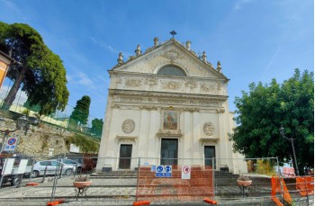
Now, turning left on the flat, you reach the parking area near the cemetery and the church of San Michele Arcangelo, in the square of Pieve Ligure Alta.
Here, you can use restroom facilities and find two bars.
From Piazza San Michele, continue a few meters on Via alla Chiesa, then leave it where Via San Bernardo begins, a slightly higher and less busy asphalt road. After passing the oratory of Sant'Antonio Abate, it continues among beautiful houses surrounded by well-kept gardens.
After the last houses, the drivable road gives way to the trail that winds through the typical Mediterranean vegetation before entering a more agricultural environment, characterized by numerous olive trees, and begins to ascend.
This stretch offers magnificent panoramic views of Golfo Paradiso.
With a final stretch on a concrete road, you pass the first houses of San Bernardo, arriving about 40 minutes from the start in Pieve, joining, on the left, the trail coming from Santa Croce.
Now, following the FIE trail marker ![]() , take the staircase that descends between the houses and immediately into the forest, passing by a campground, then merging onto a drivable road, Via Favaro.
, take the staircase that descends between the houses and immediately into the forest, passing by a campground, then merging onto a drivable road, Via Favaro.
Continuing downhill among the houses and keeping an eye on the trail marker, you reach the staircase that, alongside the gardens, descends to the overpass allowing you to cross the underlying Via Aurelia.
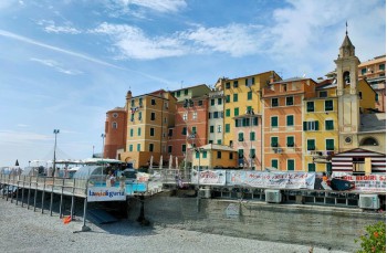
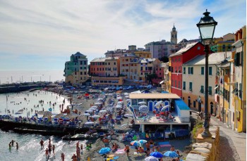
From here, with another staircase, and after about 20 minutes from the San Bernardo hamlet, you arrive in Bogliasco on the central Via Mazzini, where the itinerary ends.
In the characteristic seaside village, you can take a walk along the main street, lined with shops, bars, and restaurants.
The most convenient and fastest way to return, if needed, to Sori is by train or by bus.
The path tracked tracciato by GPS
Unlock, view and download the gpx track by becoming a Supporter.
Data sheet
| Difficulty | Low |
| Duration | 1h 40' |
| Length Km | 4,300 |
| Footpath signs | |