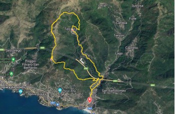
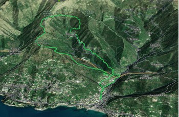
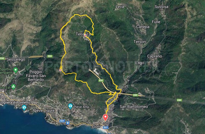
Sori - Sella Cremuiexi - Cian da Cola - Teriasca - Sori

Difficulty | Low |
Duration | 4h 00' |
Length km. | 10,500 |
Footpath sign | ![]() ![]() |
![]() ![]() ![]() | |
![]() |
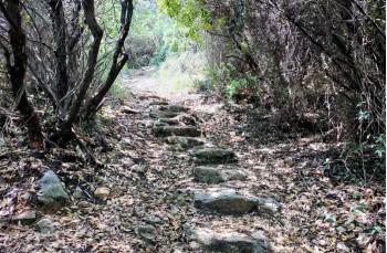
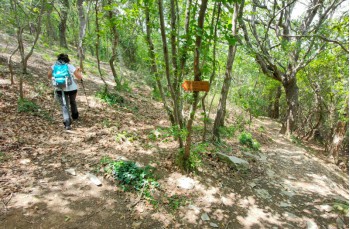
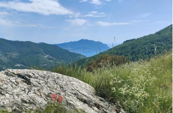
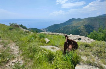
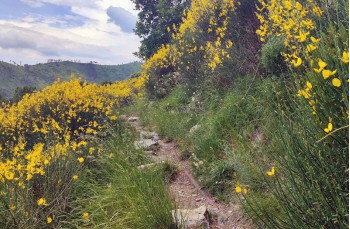
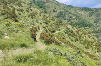
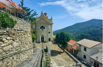
This is a circular itinerary starting from Sori, which doesn't present any particular difficulties but allows you to walk on less frequented paths surrounded by incredibly scenic landscapes. In spring, these landscapes are adorned with the blooming of various species of flowers, especially in mid-May when the broom takes center stage.
The starting point is in the center of Sori, at Via Solimano, the drivable road that leads to the hamlet of Teriasca. You need to follow this road until you reach the bridge of the highway bridge, where you leave it and take a private road that ascends to the left.
It is a partially paved drivable road that you leave shortly after when you spot a trail on the right that ascends into the woods.
This first part is the only slightly more strenuous section of the route because it is all uphill, and the incline gradually increases.
There are no trail markers, but it's difficult to go wrong if you keep ascending straight through the woods, ignoring the first deviations, until you reach a second trail junction. Here, you go a few meters to the right and immediately take the "Sentiero dei Caprioli" (Trail of the Roe Deer), which ascends to the left.
This part of trail is marked with somewhat indistinct blue and red trail markers (at the moment), but they are quite frequent and guide you until you reach a junction with a trail coming from Sori, which is marked by .
Si prosegue a destra fino ad arrivare dopo circa 1 Km a Sella Cremuiexi.
You are on the ridge, just a few meters from the border with the municipality of Bogliasco, and the view of the Gulf of Paradiso and Genoa is stunning.
You continue on a level path towards the north, and shortly after, at the foot of Mount Castelletti, you start following the trail marker which skirts around it along the coast while still gradually ascending. This leads you to "Cian da Cola", a beautiful saddle and a crossroads of trails.
On a large rock where you can still see the remnants of an old ropeway, there are some signs. You continue on the right, direction "Case Becco" and leave the trail after about ten meters to take the one below. After a few meters, this trail also splits: you continue on the higher one towards Teriasca.
It's a pleasant, gently descending trail that crosses an area that was once inhabited and cultivated, as evidenced by the presence of numerous abandoned rustic buildings and ancient stone walls that have remained intact over the years. After a little less than 2 km from Cian di Cola, you arrive at the church square of Teriasca, a picturesque and quiet village in the municipality of Sori. Here, you will also find a tap for drinking water.
You continue by going behind the church and walking along a concrete pathway until you reach the charming Chapel of N.S. della Guardia Cortino. Here, on the left, you will find another tap for drinking water.
You continue descending towards Sori on this trail, which is occasionally not well-maintained, with tall grass and loose stones caused by wild boars. The trail runs alongside the Pieve Ligure stream and eventually passes under a house, continuing along the Sori stream.
You continue to the right, following along the stream (Via Giordani), and avoid crossing the bridge over the stream. Instead, you continue to the right, where a short staircase brings you back to Via Solimano, concluding this itinerary.
Unlock view and download the trail track by purchasing a map.
Data sheet