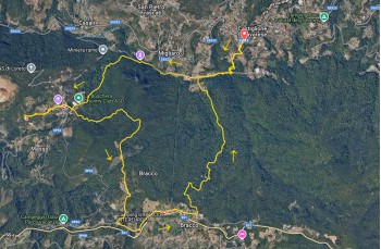
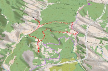
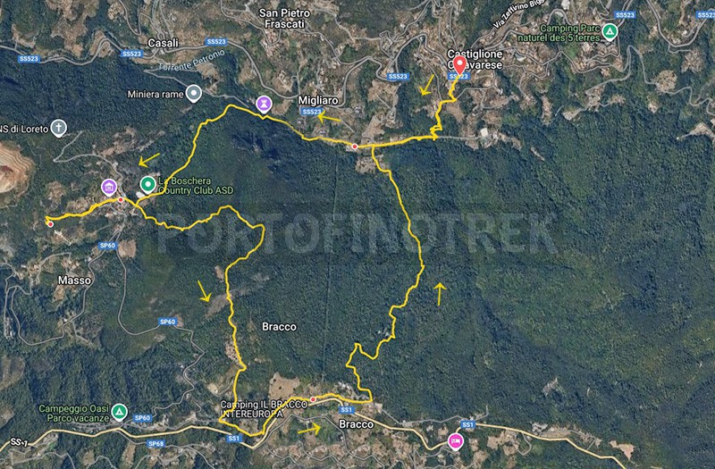
Circular trail Castiglione chiavarese - Masso - Bracco

| Difficulty | Medium |
| Duration | 3,00h |
| Length km. | 9,300 |
| Footpath signs | |
An easy and pleasant itinerary to discover some small villages of the Val Petronio.
The starting point is Castiglione Chiavarese, a hillside village about 10 kilometers from the Sestri Levante highway exit, reachable by following the SS 523.
Upon entering the village, there are a few parking spaces just after the bar and others a little further ahead, above the road. The town can also be reached by bus from Sestri Levante.
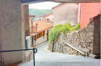
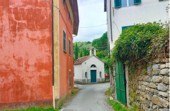
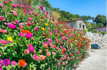
The route begins with the staircase near the bar/trattoria, descending towards the library and then crossing the most picturesque part of the village, with small colorful houses attached to one another ![]() .
.
Once on a secondary road, continue to the right for a few meters, then turn left onto the steep descent leading to two houses surrounded by gardens.
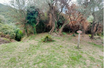
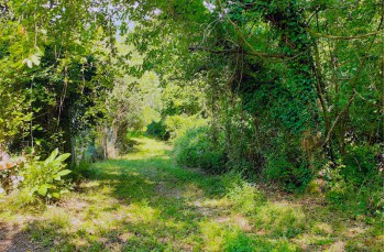
Here, a short section of trail descends into the woods, passing close an abandoned rustic building, before emerging onto the underlying Via Fiume.
Continuing to the right along the quiet road, you enter the hamlet of Fiume, a peaceful and compact cluster of well-renovated houses, a couple of which serve as B&Bs.
Here there is a drinking water tap.
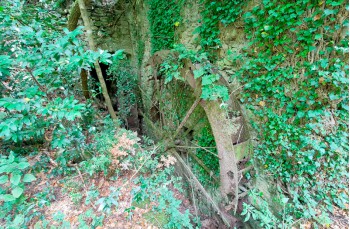
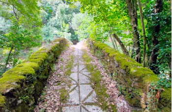
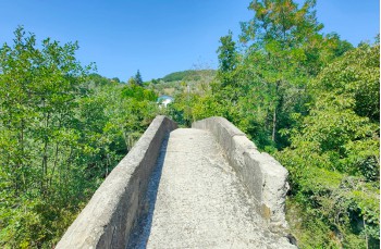
At the end of the hamlet, follow the path that descends towards the Petronio Stream, walking pleasantly alongside it on level ground, passing the remains of ancient mills, until you reach the stone bridge that allows you to cross and climb into the woods on the opposite side.
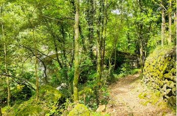
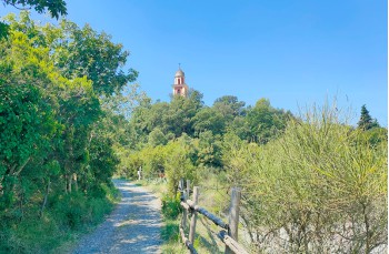
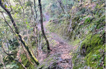
Alternating uphill stretches with flatter ones, you walk under the shade of a beautiful mixed forest of chestnut and beech trees for just over a kilometer, reaching a dirt road that runs alongside a riding school before climbing steeply towards Masso, whose bell tower can already be glimpsed.
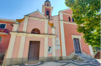
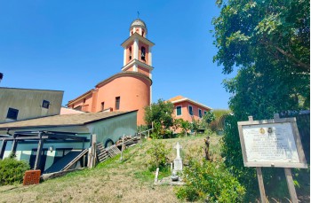
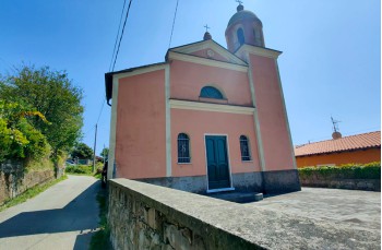
In just a few minutes, you find yourself inside this small and welcoming village, surrounded by colorful, typically Ligurian houses, with an inevitable stop in front of the Church of San Michele to admire the beautiful "risseu" (a pebble mosaic in Genoese style) and rest for a few minutes on a bench shaded by a large tree to enjoy the valley view.
In the hamlet there is a drinking water tap and one B&B.
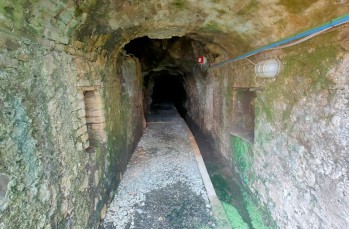
Our itinerary includes a detour to visit the mining area where copper was extracted, considered among the oldest in Europe.
You then descend through the houses to reach Via Loreto, where the Archeo-Mining Center of Castiglione Chiavarese is located. Continuing downhill, follow a small path on the right, unmarked but quite intuitive, which in about 10 minutes leads to the visitor area and the entrance gate of one of the tunnels.
For information about guided tours of the mines and the museum, check the mucast website.
Retracing the same path back, climb up to Masso and then descend again towards the riding school, but this time turn right at the junction, following the trail marker ![]() . This is a beautiful forest trail climbing uphill, with a few steeper stretches and a section equipped with useful steel cables for support, as it may become slippery when wet.
. This is a beautiful forest trail climbing uphill, with a few steeper stretches and a section equipped with useful steel cables for support, as it may become slippery when wet.
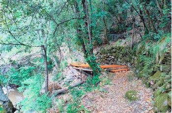
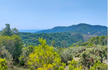
The climb offers some panoramic views of the valley and the coast up to the Portofino Promontory before reaching an equipped area with wooden benches and tables.
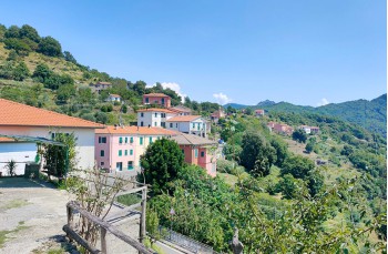
From here, continue on a wide flat path that soon becomes a dirt road leading to the paved road, the provincial road 60, which you follow to the left to reach the village of Bracco (3 kilometers from Masso), a hamlet of Moneglia located on the hill between the coastal town and Castiglione Chiavarese.
Cross the village, which stretches along the ancient Roman Road, and a few meters after the Church of San Rocco, near the Acli club, turn left onto the gravel path descending into the woods, first with a dirt road with switchbacks, then with a narrow trail that, in its final stretch, may be overgrown with tall grass.
There are no trail markers, but the path is very intuitive.
At the end of the descent, you arrive at the gate of a private property that must be crossed to reach the bridge over the Petronio Stream, allowing you to return to Fiume. From here, retracing your earlier steps to the right, you climb back up to Castiglione Chiavarese.
Unlock, view and download the gpx track by becoming a Supporter.
Data sheet
| Difficulty | Medium |
| Duration | 3,00h |
| Length km. | 9,300 |
| Footpath signs | |