Trail ring Sestri levante - Riva Trigoso

Difficulty Low
Duration 2h 50'
Length km. 6,700
Footpath sign 2 cerchi pieni + triangoli-vuoti.png + segnavia punta manara
Dislivello3m - 227m | dislivello positivo 608m | dislivello positivo 589m
StartStarting point

Passing through

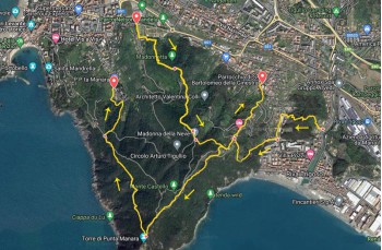
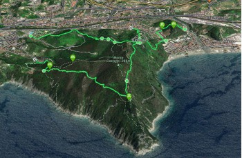
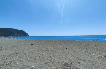
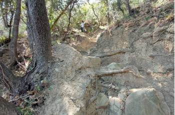
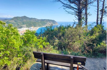
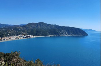
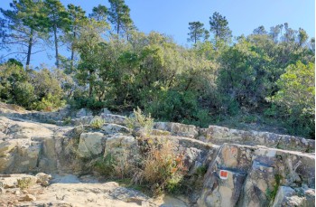
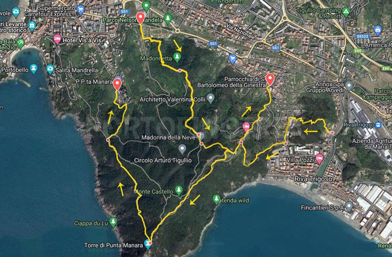
Loop hiking itinerary from Sestri Levante to Riva Trigoso that ascends the beautiful hill that divides the two towns and then descends to one of the largest beaches in the Golfo del Tigullio, thus combining hiking with swimming or, for those who prefer, relaxation on the beach.

The starting point is in Sestri Levante near the Nelson Mandela park, which is convenient for those arriving by their own vehicles due to the ease of parking, as well as for those arriving from the train station, which is only a ten-minute walk away.
From the parking lot, where the bike path begins, you can see a wooden sign on the right indicating the direction to Punta Manara.

Following the FIE fotpath sign due pallini rossi, follow the dirt road to the left, just before the farmhouse, and take the trail climbs up, passing over the archery center, and in about 15 minutes you reach Colle della Madonnetta, where a pretty little chapel stands.
Continuing on, after following the wall of a farmhouse, you will reach a fork in the path. Here, you should take the left path ascending by some cement steps and, shortly after, arriving at a second chapel dedicated to the Madonnetta della Neve.

After a few meters, you turn left towards Riva Trigoso, the hamlet of Sestri Levante nestled between Punta Manara and Punta Baffe. Here is where the descent begins, initially through the woods that gradually gives way to the countryside as you approach Villa delle Ginestre, a small cluster of houses, which you cross to follow a new trail marker due triangoli vuoti, arriving at the church of San Bartolomeo della Ginestra.
Here, we are still in Sestri Levante, but by continuing a few more meters on the asphalt road, we enter in Riva Trigoso and quickly reach its beautiful beach, the main attraction of the area. However, it's also worth visiting the rest of the village, with an older and more authentic area as well as a more modern and commercial one.

To return, we recommend going back up along the left bank of the torrente Petronio, until you reach the staircase that leads to the Parco di Monte Pagano, which can be identified by a slightly handmade signpost, located on the left side after a little over 400 meters.

It's a pleasant path that winds through cultivated terraces and shaded by pine trees, equipped with benches and wooden tables, which leads to Via Vattuone, already traveled on the way to the sea. Follow it for a few meters until you find the entrance to the return trail on the right (Le Rocche bivio).
Here, the ascent begins, sometimes steep with irregular steps that slightly increase the difficulty, but you'll be rewarded with incredible panoramic views of the bay and Punta Baffe.

Passing again through Villa delle Ginestre, at the junction, take the direction to Torre di Punta Manara which is reached after just over 1 km and about 30 minutes of walking. For those who have never visited the place, it's worth a small detour to climb up to the top and enjoy the wonderful view.
Here turn right to return to Sestri Levante, along the most scenic stretch of the route.

This is one of the most fascinating trails in Liguria for the naturalistic context in which it develops: you walk on rocky terrain (which requires some attention in descent) surrounded by typical Mediterranean scrub, accompanied by a breathtaking sea view.

Once arrived at the junction, we decided to turn right and take the descent towards the cemetery which, in about 500 meters, leads first to a dirt road and then in front of the Sestri Levante cemetery. From here, following the drivable road, it is very easy to return to the starting point or to the center of Sestri Levante.

Unlock, view and download the trail track by purchasing a map.

Our GPS path


Data sheet

Time
From 2h to 3h
Length Km
6 - 8
Difficulty
Low