Circular trail Recco - Megli - Sant'Apollinare - Polanesi - Mulinetti

| Difficulty | Low |
| Duration | 2h 30' |
| Length Km | 6,900 |
| Footpath signs |  |
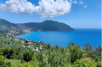
This is a hiking trail on the heights of Recco that has as its destination the panoramic church of Sant’Apollinare.
The itinerary starts in Via Cavour ![]() where, on the right (at the traffic light), there is a staircase that allows you to reach the hamlet of Megli in 20 minutes, at the church of Nostra Signora delle Grazie, from which you can enjoy a magnificent view.
where, on the right (at the traffic light), there is a staircase that allows you to reach the hamlet of Megli in 20 minutes, at the church of Nostra Signora delle Grazie, from which you can enjoy a magnificent view.
There is a drinking water tap here.
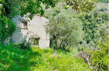
Walk along the left side of the church to continue on the staircase that goes up, ignoring the first right turn to reach a second fork, where you must follow, to the left, Via alla Pineta. The path, without any trail markers, crosses the countryside and, at the fork, continues to the left to intersect with Via della Giudea.
Here you continue straight, now following the FIE trail marker
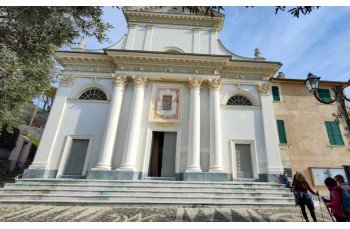
A signpost indicates the various directions, the one for our itinerary is the climb marked by ![]() which, crossing the woods, climbs up to Pineta Polanesi, then descends and, with a final short stretch on rocky ground, reaches the flat path, partly concrete, that soon ends behind the Church of Sant’Apollinare, in the municipality of Sori.
which, crossing the woods, climbs up to Pineta Polanesi, then descends and, with a final short stretch on rocky ground, reaches the flat path, partly concrete, that soon ends behind the Church of Sant’Apollinare, in the municipality of Sori.
The panorama accompanying this part of the route and the enviable position of the small church, built in the Romanesque era, make it all very suggestive.
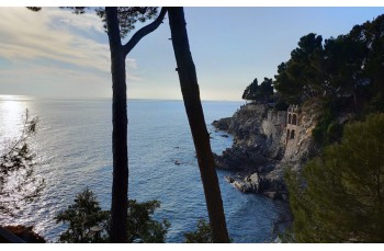
For the return, take Via Belvedere again but after a few meters leave it to descend to the right and follow the Sentiero Liguria ![]() , a trail, initially concrete, that, skirting houses and terraces, seems to dive into the sea.
, a trail, initially concrete, that, skirting houses and terraces, seems to dive into the sea.
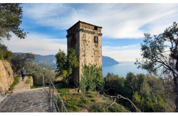
This way you reach Strada della Baggiara, the more rural path below that passes in front of the Saracen tower and shortly after arrives at Polanesi in the locality Campetto, from here you descend along the eponymous street to the right to reach the church of San Martino.
Skirting the church, continue on the flat path towards Recco until you come across a staircase that descends to Mulinetti, on Via Aurelia.
Continuing east you pass the bridge to descend to the right and take the underpass that leads to Via Garibaldi, a pleasant secondary road overlooking the sea that, in about 10 minutes, leads to Recco.
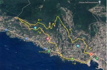
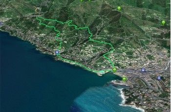
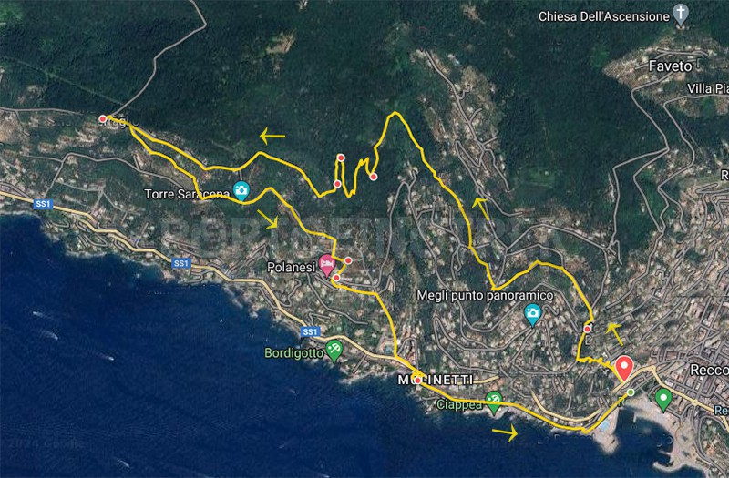
The path tracked tracciato by GPS
Unlock, view and download the gpx track by becoming a Supporter.
Data sheet
| Difficulty | Low |
| Duration | 2h 30' |
| Length Km | 6,900 |
| Footpath signs | |