- Out-of-Stock
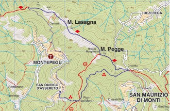
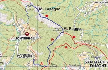
San Quirico d' Assereto - Monte Pegge - Montepegli


| Difficulty | Medium |
| Durata | 2h 30' |
| Length Km | 4,500 |
| Footpath signs | |
Rapallo has a dense network of paths that in ancient times connected the different hamlets but which after the construction of the more comfortable asphalted roads, has been partly abandoned and neglected. Our search for these ancient mule tracks has allowed us to build a very pleasant loop itinerary.
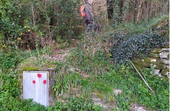
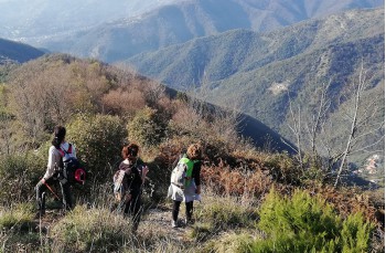
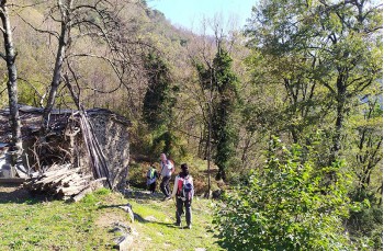
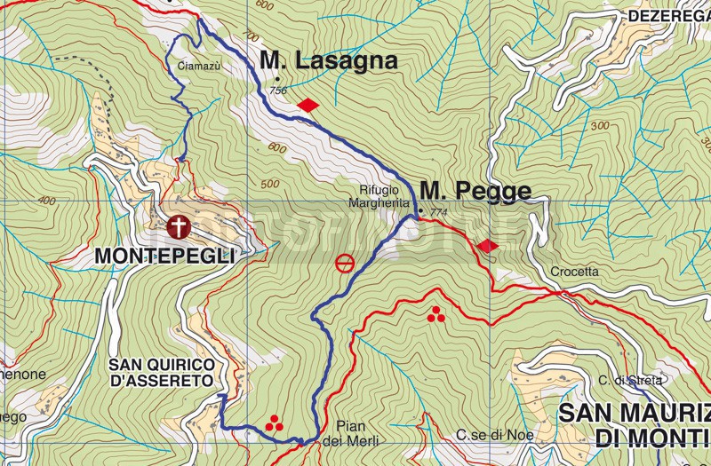
The departure is from San Quirico di Assereto , a nearby hamlet of Rapallo which can be reached in 10 minutes by car from the motorway exit and connected to the city center by small buses. The path starts near the church and the cemetery which can be reached via a short concrete slope; after a few meters you leave it to proceed, on the left, on the well-marked mule track with ![]() , which climbs into the woods, sometimes with irregular stone steps, and in about 20 minutes you will reach Passo San Quirico , also known as Pian dei Merli, a beautiful lawn with an old stone house now abandoned, reflecting the ancient settlements.
, which climbs into the woods, sometimes with irregular stone steps, and in about 20 minutes you will reach Passo San Quirico , also known as Pian dei Merli, a beautiful lawn with an old stone house now abandoned, reflecting the ancient settlements.
Cross the lawn to resume the path towards the north (going down to the right you can reach the Monte delle Pozze and the "Black Madonna") and at the crossroads, leave the path on the right that leads to Passo della Crocetta, continuing to the left following the sign towards "Monte Pegge" and the ![]() .
.
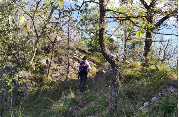
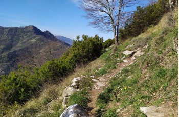
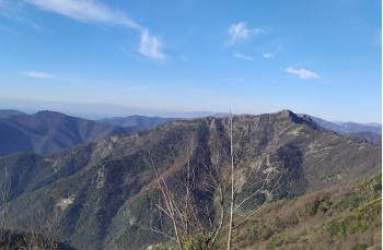
Initially it advances on level ground then gradually gains height and culminates with a passage on the rock and a 360° view of the surrounding mountains that precedes the arrival at Rifugio Margherita, on Monte Pegge.
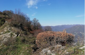
After a stop to admire the view, go around the refuge on the left, where tables and wooden benches have been placed, and proceed until you find the path marked by a ![]() . You go down in the middle of a hazelnut wood and then continue along the coast and on the flat, on a narrow but well-kept path, completely open that advances towards the Manico del Lume.
. You go down in the middle of a hazelnut wood and then continue along the coast and on the flat, on a narrow but well-kept path, completely open that advances towards the Manico del Lume.
Once you reach Passo di Montepegli, just under 1.5 km from Rifugio Margherita, local signage indicates that you should descend near a wooden and metal hut.
There are no trail markers, but the path is clear; descending through the woods, you arrive at a stone building set in a الجميل meadow, known as Cian de Mazun, where a cableway for transporting materials is also visible. In front of the building, continue descending along a stone staircase punto-linea-verticale.png (very slippery when wet), cross a small dry stream, and gradually approach the village of Montepegli.
Upon reaching a rock with some indications, ignore the descent and continue straight ahead through the woods until you emerge onto the road near the stone houses of Co' di Montepegli. Pass by this small cluster of houses, then go down a stone staircase and continue again through the woods, following the narrow but clear path which shortly leads to San Quirico, thus completing the loop.
Unlock, view and download the gpx track by becoming a Supporter.
Data sheet
You might also be interested in
| Difficulty | Medium |
| Durata | 2h 30' |
| Length Km | 4,500 |
| Footpath signs | |