- Out-of-Stock
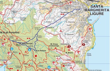
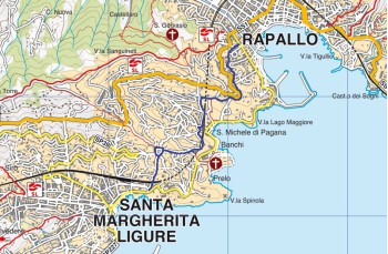
Rapallo - Santa Margherita Ligure


| Difficulty | Low |
| Duration | 40' |
| Length Km | 2,100 |
| Footpath signs | None |
What we propose here is not a trekking itinerary, but a pleasant walk connecting Rapallo to Santa Margherita Ligure, avoiding the traffic of the coastal road.
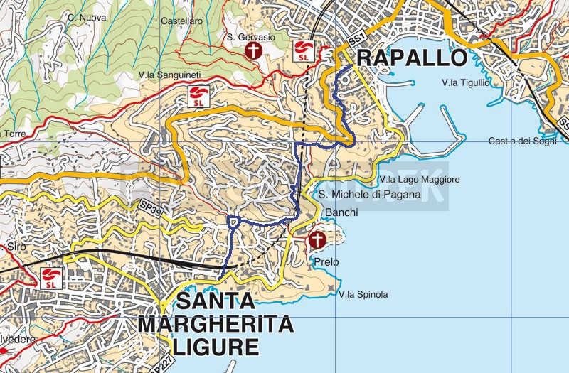
The starting point is on Corso Colombo, near Ponte Annibale. Close to the bridge, an information panel introduces the Emperor’s Path, a route that initially winds between buildings before reaching the Chapel of San Nicola, on Via Aurelia. From here, it becomes a pleasant flat path that crosses an area of villas and gardens, offering some panoramic views over the Bay of San Michele.
Ignore all the side paths you encounter (those on the left all descend towards the beach) and continue straight ahead until you reach a road in San Michele di Pagana.
Continue now along Via degli Aranci, taking the staircase on the left that goes down and, running alongside the railway, meets Via Meucci, which you should follow for a few meters to the right, then continue along Via Fioria towards the sea until, before passing under the railway bridge, you find on the right Via Donega.
The path, very narrow, is located at the beginning of Via Donega, on the left, between the staircase of a condominium and a small private road leading up to some houses.
The mule track, which further on is called Via Banchi, climbs between two high walls and reaches a first junction, where you turn right to follow, for a short stretch, the Flemish Path and thus arrive at P.so dell'Alloro. Here you turn left, passing in front of some houses, to reach a staircase from which you can enjoy a wide view over Santa Margherita Ligure.
Go down the stone steps which, with a passage above the railway station, lead to Santa Margherita Ligure on Via Roma, at the intersection with Via Pagana.
Unlock, view and download the gpx track by becoming a Supporter.
Data sheet
You might also be interested in
| Difficulty | Low |
| Duration | 40' |
| Length Km | 2,100 |
| Footpath signs | None |