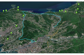
Rapallo - Portofino Vetta - Ruta ring trail

Difficulty | Low |
Duration | 3h 00' |
Length Km | 11,500 |
Footpath signs | ![]() ![]() ![]() |
![]() ![]() ![]() | |
![]() |
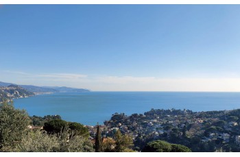
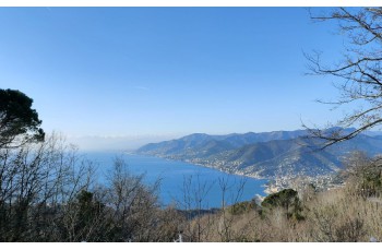
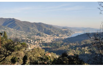
Here we are proposing a walking trail starting from Rapallo to reach Portofino Vetta; once you reach your destination, you can continue for other different directions (Here the trails starting from Portofino Vetta).
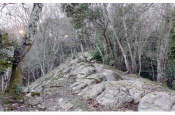
The starting point is from the roundabout in S. Anna where you continue crossing the Boate stream and shortly after take a small pass on the right just before Via Sbarbaro, the first vehicular crossroads of the most known Via Milano.
You walk behind a pink apartment building and continue up a concrete staircase; you then cross a private driveway and, after skirting some houses with a broad view of Rapallo, you cross a more rural environment to enter the woods.
Reached a crossroads (there are signs but they are a little faded) continue to the left to quickly arrive at the church of SS. Gervasio and Protasio and still straight ahead until you come to a stairway which you must follow uphill to reach a house on Via per San Lorenzo.street
Si tratta di una strada asfaltata ma piacevole perchè tranquilla e poco trafficata che, in alcuni punti, offre dei bellissimi scorci panoramici sul mare.
After about 600 meters you have to pay attention because you leave the driveway to continue on the right on a small path, always following the trail sign (a little faded) of Sentiero Liguria. Continuing straight on, you find yourself on Via Torre San Gioacchino and therefore in San Lorenzo della Costa.
After a few meters on the provincial road, go up to the parish church (which is worth a visit) and continue (back to the church) to the right uphill on a short concrete staircase that goes up between the houses and leads to Via Simone Stefani , which you need to follow briefly to the left until you find (on the right) the indicator post of the Portofino Park.
Follow the path (not always clean) that climbs between the bands and runs alongside a farmhouse where you can see a pair of donkeys nearby to end up in the parking lot of a resort, which you skirt along a beautiful stone staircase.
This brings you to the woods which you have to follow to the left, gently uphill, to reach Portofino Vetta after about 15 minutes.
The route continues to the right but we add a small ring by going to the left, passing the barrier, up to the ladder that goes up to the right and passing behind the hotel you will arrive at a beautiful panoramic point from which you can admire the whole Golfo Paradiso to Genoa and soon takes us back to our detour.
From here, just follow the path that goes down into the woods () to get effortlessly to Ruta di Camogli.
Follow Via Bana to the left which, passing in front of the church of San Michele Arcangelo, connects to the main road, Via XXV Aprile; going uphill you will arrive at the Millennial Church, the ancient parish church of Ruta di Camogli immersed in the greenery of a well-kept garden, with a view of the Gulf.
Keeping on the road for about a hundred metres, after passing the cemetery, a path can be identified on the left which goes up parallel to the provincial road below and reaches the church of San Martino di Noceto, crossing a peasant environment and passing in front of the Fons Gemina, a source (probably) dating back to Roman times called "twin" because the water flows from two different points.
From the church, always following the F.I.E , take the path on the left which crosses a wood and then descend between the houses along Salita Caravaggio. After a few meters downhill on the provincial road, you find the short path that leads to Via Cavagino and therefore to the Santa Maria del Campo church.
From here it is possible to return to the city center by feet (about 3 km) or by the public busses.
Unlock, view and download the trail track by purchasing a map.
Data sheet