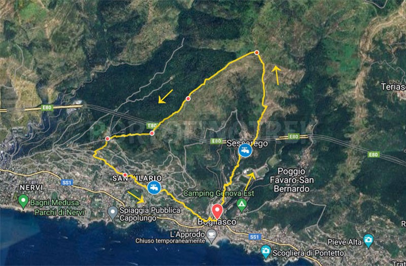
Difficulty | Low |
Duration | 3h 30' |
Length km. | 7,400 |
Footpath signs | ![]() ![]() ![]() ![]() |
![]() ![]() ![]() | |
![]() |
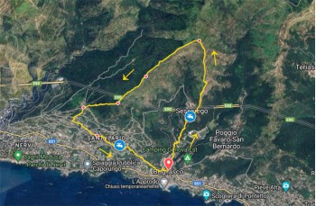
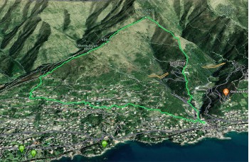
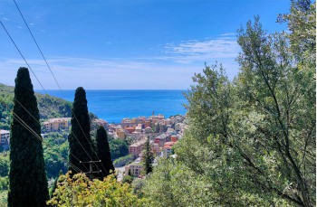
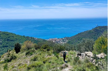
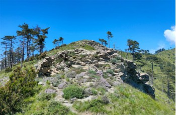
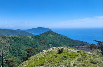
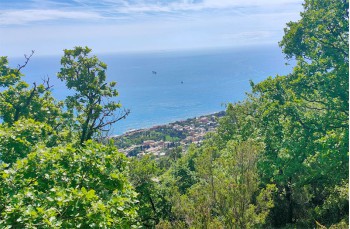
This is a circular itinerary starting from Bogliasco, a renowned coastal town in the Golfo Paradiso, not particularly challenging but highly scenic.
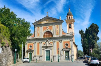
In the first part of the route, there are no trail markers, but the path is always clear. The starting point is in the center of the town, near the municipal swimming pool, which you follow along Via Cavour until you encounter on the left, a staircase that allows you to climb up to Via Sessarego.
You walk along the asphalt road, to the right, to reach a small parking lot where you leave the road to continue, still to the right, along the steep path that cuts across the road and reaches the hamlet of Sessarego in about 20 minutes.
You cross the picturesque village and, after passing the restaurant, instead of heading towards the church, you continue to the right, taking the staircase that climbs steeply.
Here there is a drinking water faucet.
After passing the last houses, now walking on a rocky path, you reach a junction, where you continue to the left following a very scenic route that progresses on a slight incline. In addition to enjoying beautiful views of the sea, you can admire an area where the typical Ligurian terraces are still evident near an abandoned rustic building, evidence that the area was cultivated in the past.
Arriving at the foot of Bric Gianesi, instead of following the path that continues to the left, our route cuts straight to the summit, a slightly more challenging but faster alternative.
From the top, an ideal resting place, the view is nothing short of stunning, with the promontory of Portofino and Punta Chiappa in the background.
Continuing to enjoy the sea view, you descend and soon encounter the path coming from Monte Cordona, which is part of the Columbus Historical Trail, and the first trail marker of the route . Follow it to Passo Crocetta where the path divides to reconnect lower down.
Here there is a fountain marked, which we did not verify.
So, abandon to continue to the left on flat ground and reach Monte Giugo (485 m). Now the FIE trail marker appears
which will guide you to Sant’Ilario.
Crossing the clearing, you descend to a small cluster of houses in the locality of Serra di Cantalupo, where several trails converge, including the variant encountered at Passo Crocetta.
Our route continues with the staircase, still marked with the same trail marker that descends to the left along the wall of a house.
This stretch is uneven and rocky and requires some attention until you reach a large abandoned building with the inscription "Fossa dei Carboni di sopra", a locality named after its position, between two ridges ("fossa"), and Carboni, the name of an ancient family originating from this place (source: santilarionline.it).
Here there is a junction, both directions are fine to reach Bogliasco, but our route follows the path to the right which, passing by some houses and walls, soon ends on the asphalt road, Via dei Marsano.
Continue downhill to the left until the Church of Sant’Ilario to skirt it on the right for a few meters along Via alla Scuola di Agricoltura until you spot, still to the right, a staircase descending.
This is a pleasant pedestrian street that passes through beautiful houses, first on level ground then downhill, changing names: Via Penco, Via della Zuccona, Via Armanna.
When the latter becomes Via Frittallo, abandon it to descend along the stairs to the right which, after cutting across Via Gian Francesco De Marchi, ends in the heart of Bogliasco where there is also a good and varied choice of venues.
The path tracked on Google Maps
Unlock, view and download the gpx track by becoming a Supporter.
Data sheet
- Time
- From 3h to 4h
- Length Km
- 6 - 8
- Difficulty
- Low