- Out-of-Stock
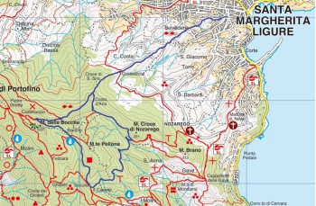
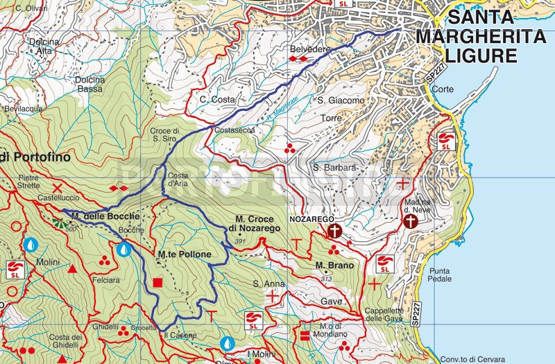
Trail ring Santa Margherita Ligure - Nozarego - Bocche - Busseo


| Difficulty | Medium |
| Duration | 3h 00' |
| Length km. | 9,370 |
| Footpath signs | |
The starting point is in Santa Margherita Ligure, on Via Costasecca, the street near the Town Hall square that climbs behind the church.
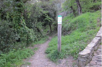
Follow the road for a few meters, then continue to the right onto the mule track that runs alongside terraced fields and private properties and is marked by two diamonds (![]() ).
).
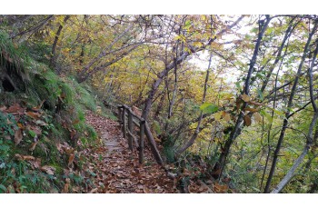
The mule track, entirely uphill, alternates steps, short drivable sections, and gravel stretches. Along the route there are several junctions, but you should always continue straight ahead. After passing the last houses, the climb—developing in the shade of holm oaks, chestnut trees, and oaks—becomes particularly steep and at times uneven.
After about one hour of walking from the start, you join the wide Portofino Vetta - Portofino Mare trail, which you follow to the left (main direction) to descend to the Bocche area, where there is a rest area and a drinking water tap.
Continuing downhill, after about 15 minutes, a park sign indicates the locality of Crocetta.
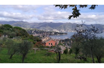
Here, behind the bench, begins the path heading towards Nozarego: it is a forest trail with no particular difficulties and is very pleasant. As you descend, you begin to catch glimpses of the sea, culminating in a postcard-like view that opens from Nozarego over Santa Margherita.
The trail arrives behind the Nozarego cemetery; here you continue left towards Busseto along the path which, after about 10 minutes, becomes a drivable road and, passing next to a restaurant, descends to a junction. Here, to the left, a steep paved road climbs to a small group of houses known as Busseto (or Busseo).
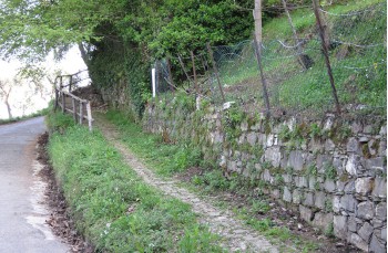
After the last house, although somewhat hidden by vegetation, there is a narrow path which, in a further 10 minutes, passing through the terraced fields, reconnects with Via Costasecca, the same path taken on the way up, at the level of a stone house.
From here, follow the same path back to complete the loop and return to the starting point.
Unlock, view and download the gpx track by becoming a Supporter.
Data sheet
| Difficulty | Medium |
| Duration | 3h 00' |
| Length km. | 9,370 |
| Footpath signs | |