- Out-of-Stock
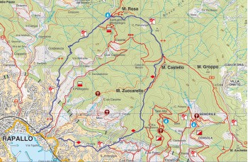
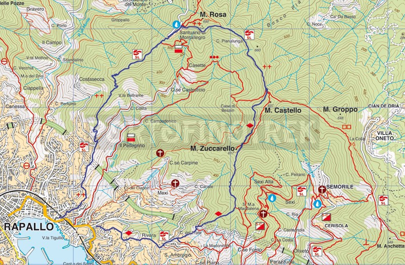
Rapallo - Sant'Ambrogio - Montallegro - Rapallo


| Difficulty | Medium |
| Duration | 3h 50' |
| Length Km | 9,900 |
| Footpath signs | |
You can support us by becoming one of our Supporters.
A great little help that will allow you to access all the contents of the site.
Are you already Supporter?
Log in now
A beautiful itinerary that winds its way through the hills of Rapallo through scenic areas and dense woods.
Our journey begins in Via Pietrafraccia , a side street of the Via Aurelia di Levante, opposite the entrance to the Casale Park.
We take Via Sant'Ambrogio , a mule track that you meet immediately on your right. The path consists of a steep concrete staircase that climbs between high...
You can support us by becoming one of our Supporters.
A great little help that will allow you to access all the contents of the site.
Are you already Supporter?
Log in now
| Difficulty | Medium |
| Duration | 3h 50' |
| Length Km | 9,900 |
| Footpath signs | |