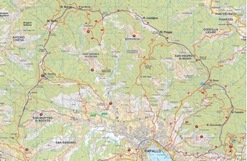
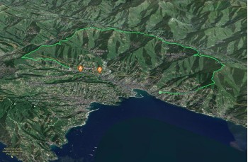
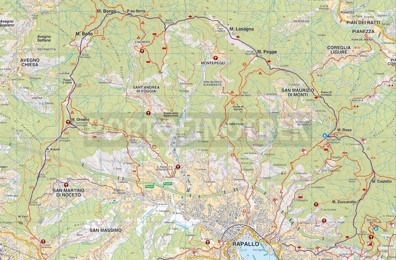
Fulvio Tuvo trail itinerary from Rapallo

Difficulty High
Duration 9h
Length Km. 22,700
Footpath signs Rombo rosso + Doppia croce + + 3-pallini.pngQuadrato vuoto + + + Cechio puntato
Dislivello 11m - 801m | dislivello positivo 1420m | dislivello positivo 1391m
StartStarting point
Passing through

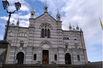
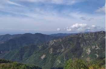
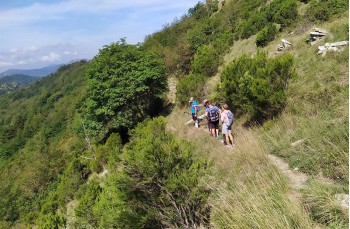
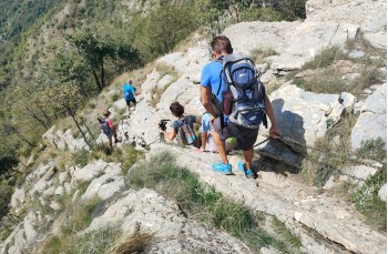
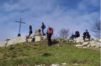
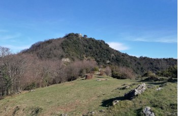
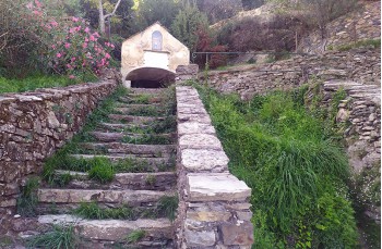
On 25 September 2022 the Rapallo CAI section wanted to pay tribute to his partner and friend Fulvio Tuvo , who suddenly passed away in 2021, dedicating this itinerary to him that winds along the heights of Rapallo, touching all its peaks, amidst incredibly beautiful panoramas.

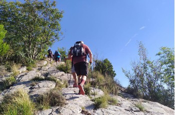
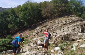
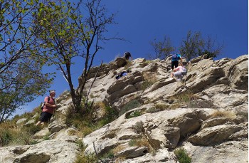
Due to the duration and the passage to the Manico del Lume, equipped with chains, the route is considered challenging, consequently suitable for experienced and trained and well-equipped hikers.
Furthermore, since there is only one water source in Montallegro, it is advisable to leave with an adequate amount of water (at least 2 liters per person) and avoid the hottest and sunniest months.

The departure is in Rapallo in Via Pietrafraccia (on the eastern Aurelia opposite the entrance to the "Parco Casale") where on the right you can see a small bridge with the indication to Sant'Ambrogio which can be reached in about 20 minutes along the mule track. It begins with a steep staircase and then alternates flatter sections with short climbs.
On the church square, take a few minutes to admire the wonderful panorama that surrounds you.
There is also a drinking water faucet here.

After passing the church, continue on Via San Bernardo for about 100 meters and then continue on the mule track to the right of the Cappelletta Sant 'Isidoro , continuing to climb following the trail sign Rombo rosso. The stone staircase climbs crossing a driveway before entering the woods, where a few short flatter sections break the climb.
Once you reach a small votive shrine, leave the red rhombus to follow the path that climbs to the right, marked by a provisional red sign, which in about 20 minutes allows you to reach the 666 meters of Monte Castello, where you can see a reconstruction of the Castrum Rapallinum plant.

A short descent leads to the main path, now wide and flat, which, shaded by the bush, reaches Montallegro, where you can use the service of some bars, restaurants and public toilets.
To the side of the Sanctuary there is the last possibility to refuel with water by operating the ancient hand pump.

Always keeping to the initial path you will reach the Passo della Crocetta and from here, crossing the driveway, you will climb up to the Margherita Refuge on Monte Pegge, accompanied by beautiful panoramic views.
The refuge is managed by the "Gruppo Alpini Rapallo" and it provides benches, tables and a fireplace to hikers, providing also shelter in the event of adverse weather conditions.

After the inevitable stop, we resume our journey, always following the red diamond (rombo rosso) which, after crossing a hazelnut grove, touches the slopes of Monta Lasagna, continuing mainly on the flat up to the locality of Ciassea, recognizable by its characteristic rocky conformation, which you cross in a linear manner until you reach the wood again.

From here you start to climb again until you cross the ridge path "also known as the bench path" marked with Linea rossa which, after the last stretch of climb about a hundred meters long, leads to Manico del Lume (801 meters above sea level).

Continue the route descending from the north side with a challenging stretch aided in some points with chains that help during the descent and ascent on the rocks; ATTENTION! Due to the presence of some chains this section of the path is classified as EE (Expert Hikers), we recommend extreme caution.

The signpost here is an empty triangle which, after passing the stretch with chains and after the descent, leads to the 690 meters of Passo Serra where ou have to ignore the path marked with XX, which leads to Passo della Spinarola, and where you can also leave the Triangolo vuoto taking the path which starts between these two recently signed by 3-pallini.png. This will bring you up to Monte Borgo and after a series of ups and downs of about 1.5km arrives on the top of Montebello and its 740 meters above sea level (The stretch between Monte Borgo and Montebello can be challenging and is currently marked by temporary signs).

We begin the descent towards the slopes of Montebello continuing following Due cerchi vuoti up to Passo del gallo , an area equipped with benches and tables and a beautiful lawn. Continue for a few meters up to Pian del gallo where the climb to Monte Orsena begins and reaches the Sanctuary of the Madonna di Caravaggio. Here you can enjoy a beautiful view of the Gulf of Tigullio.

The descent begins right in front of the church and arrives at the heliport where you turn right until you reach the Piane di Caravaggio where you take the last climb of the path that leads to the top of Monte Ampola, the last peak of the route from which you can enjoy a fantastic panorama that embraces the Gulf of Tigullio and Paradiso, and on clear days it is possible to see the whole Ligurian coast.

You go down until you get to Pian di Cren, from here, continuing on a flat path and always following Due cerchi vuoti you'll arrive at Esoli Nord where begins the descent towards Santa Maria del Campo on the left, marked by the signpost Circle with point. After a first part in the woods it crosses the hamlet of San Martino di Noceto , passing through the "Fons Gemina", a source (probably) of Roman origin from which two springs gush different.
Always following the path you will reach the church of S. Maria del Campo where this wonderful trail ends.

S. Maria is connected by public buses that connect it to the Rapallo train station every hour.

Unlock, view and download the trail track by purchasing a map.

GPS path on Google Maps

Data sheet

Time
More than 7h
Length Km
more that 15
Difficulty
High

You might also be interested in